Ram Heavy Duty Forum

Register a free account today to become a member! Once signed in, you'll be able to participate on this site by adding your own topics and posts, as well as connect with other members through your own private inbox!

2021 RAM 3500 Tradesman | AEV Prospector | FWC Grandby

ramblinChet

Drinks Alone
Joined
Dec 24, 2020
Messages
476
Reaction score
1,937
I’ve read a handful of posts on here of others who have lost that ring on their driveshaft. Seems like most cut it off and motor on. What’s your plan?

Not sure just yet - I figure it is there for a specific reason and first I need to understand that. I will keep everyone updated but right now it appears to be doing fine as-is.
 

ramblinChet

Drinks Alone
Joined
Dec 24, 2020
Messages
476
Reaction score
1,937
As I worked my way north-west out of Silver City, New Mexico, I began to enter the Gila National Forest which then slowly turned into the Apache-Sitgreaves National Forests. You may wonder why I pass by some areas or spend time in others - very good question. The reason I travel this way is because I like to leave areas undiscovered so next time I am in the area, I have something new to explore. Yes, there is so much to see and learn about but I simply enjoy the somewhat random wandering.

So, as I am driving along I notice a sign for the Petrified Forest National Park and I immediately think back to my childhood and seeing a picture of a petrified tree in elementary school. As I fuel up and take time to search iOverlander and notice a free camping area at the southern entrance to the park. Perfect, I am as good as there. I met some cool guys driving a Sportsmobile Classic 4x4, which I toured Washington in a few year ago, along with others in trucks with hard-side campers.

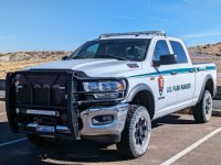
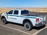
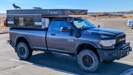
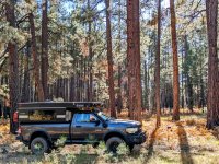
As the sun rose I pulled up to the gate the moment it opened and the fun soon began. For those Power Wagon lovers I am happy to report that one of the official vehicles at the park was a RAM Tradesman which included the Power Wagon package. A perfect ride for the area!
PFNP 01.jpg

They has Westin HDX grill guards, Rigid LED light bars, along with lights and radios, but were otherwise stock. This was parked near one of the trails which permitted you to walk out into the various sections to see the petrified wood up close. I guess there is a huge problem with people stealing petrified wood which is unfortunate. If this continues then eventually there will be none left for future generations to see. It was easy to see the fresh breaks on some of the logs where someone had stole a piece.
PFNP 02.jpg

My only wish while taking these pictures and writing this is that you could have been there to observe this breathtaking beauty in person. I have never given a second though to visiting a petrified forest but right now I can say that one day I will return and I will take even longer. The drive through the park is only twenty-eight miles from north to south and if you stop at a few of the observation areas I guess you can pass through in half a day. For me it took closer to a full day and if I had someone else with me my guess is I would have spent a full day, or possibly longer, at the site.
PFNP 03.jpg

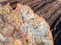
Here is a piece of petrified wood - as you may be expecting me to say, the picture does it no justice. The various colors in the crystal are created by contaminants such as: iron oxides (red, yellow, orange, and purple), manganese oxides (black and grey), or pure quartz (white). Whenever I see the words white and pure in close proximity, I always wonder why most brides still wear a white dress, which historically represented purity and innocence. How very far we have fallen - myself included.
PFNP 04.jpg

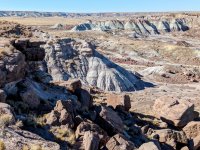
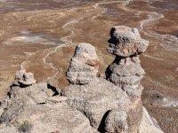
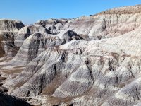
Visiting the Petrified Forest National Park is kind of like a two for one special since it also contains the south-east corner of the Painted Desert. I stood speechless after taking this picture...
PFNP 05.jpg

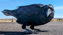
During one of my stops I noticed a raven hanging around my AEV Prospector and Four Wheel Pop-up Camper. I watched and he realized I was watching - it was funny. He actually tried getting into my camper through the fan on top. Since I was taking my time I decided to be a bit playful and talk with him. As I walked and talked he replied. Nature is funny.
PFNP 06.jpg

This was taken with my phone camera being held in my hand so you have an idea of just how close this raven was - I laid down and this curious bird flew down to see just what I was up to. My late father had a relationship with ravens also. The people there must have thought I was crazy but if you know me, I truly don't give a damn what others think of me - I am a free man, take it or leave it, I'll just be myself. Thank you. What's even funnier is I swear this same bird followed me to several other stops along the way. Maybe I am wrong, or maybe I am crazy, lol.
PFNP 07.jpg

These hills speak and tell a story. The only sound was sound was the occasional light wind through - it was very quiet. If you have not been west of the Mississippi, you must visit the area. Every time I visit I tell myself I will eventually move out here and I believe some day I will. When I was a boy I remember my father sharing stories about his time spent in the Nevada desert. He did his best to explain but there are no words which accurately describe the feeling out west. He concluded that I just need to visit and see for myself. Dad, you were correct, once again.
PFNP 08.jpg

Up at the north end of the park is the area where old Route 66 passed through. I have been around the world and there is not another country I have visited that is even close to these United States. If you are considering exploring you should already be on the road doing so. I am here to tell you that playing by society's rules and conforming to these new strange plans such as school, work, consume, family, consume, and death, will leave you lying on your deathbed wishing you had lived a very different life.

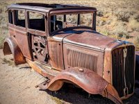
The people who purchased this car when it was new are forgotten, their car is now junk. Their grandchildren knew a bit about them, their great-grandchildren really have no idea who they were or what they stood for, or what they did. The successive generations may see them as a picture on the wall and not even know their names. All of their property will either be owned by someone else or decaying in a landfill. They have been forgotten by all except God. Stop working like a slave to purchase expensive items which are slowly transformed into rubbish that no one wants. Stop planning to do something soon, or next year. Lean forward and break the rules - live life and create memories.

And in the streets, the children screamed
The lovers cried and the poets dreamed
But not a word was spoken
The church bells all were broken
And the three men I admire most
The Father, Son, and the Holy Ghost
They caught the last train for the coast
The day the music died

And they were singin', "Bye-bye, Miss American Pie"

PFNP 09.jpg
 
Last edited:

ramblinChet

Drinks Alone
Joined
Dec 24, 2020
Messages
476
Reaction score
1,937
Part 1 of 2

Next on the list was a trail selected by Dennis, a buddy of mine from Delaware, who I have been sharing trails around the country with for around five years. The trail he selected was the Sedona Backcountry Trail as found on Overland Trail Guides. This 250+ mile trail should take four to seven days and is composed of "graded dirt roads, and occasional rocky Jeep track." In my opinion it was a very nice trail with a mixture of conditions in addition to a wide variety of scenery.

As described on OTG, "Explore the Red Rocks and allure of Sedona's canyon country. Deep into the mountains and overlooking Sedona and the Verde Valley region, the Sedona Backcountry Trail provides the perfect mix of recreation, relaxation and rejuvenation."

SED 01.jpg

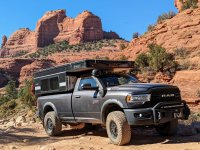
Our initial heading was east as we departed Sedona and began the rocky climb up Schnebly Hill and into the Coconino National Forest. The trail here is busy and bumpy and even aired down you are usually only moving along at 2-3 mph while dodging pink Jeeps. It was interesting to crawl behind a load of tourists and what I noticed is there always seemed to be one who was really interested in studying this AEV Prospector and Four Wheel Camper combination. Even more surprising, the majority of time it was a female. It is exciting to know that more are becoming curious of the overland lifestyle and it is my belief that the "trend" here in these United States is still in its infancy.
SED 02.jpg

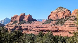
This is a majestic view of the red rocks of Sedona from an overlook near the top of Schnebly Hill. This is approximately where the pink Jeeps stop and unload before turning back down the hill. It was also a point along the trail where our pace picked up slightly. The opening of the Sedona Backcountry Trail is slow and rough so I would highly recommend airing down for comfort. I climbed out in two-wheel drive with barely a slip.
SED 03.jpg

Yeah, after nearly 55,000 miles on my BF Goodrich All Terrain KO2s, I am exceptionally happy with their performance. They are a premium tire which other companies use a benchmark and after two years of use and abuse, I fully understand why. In case you are interested, during normal driving I inflate the tires to 3 atm, or 45 psi, according to the sticker placed in my door jamb by AEV. If the trail has some rocks and is occasionally rough for short sections, and there are other short sections where I will be on paved road for a few miles, I will run at 2 atm. If I find myself on a trail that is over 100 miles long and there will be extended sections where it will be rough, I run them at 1 atm.
SED 04.jpg

This trail may not appear to be too rough but after a dozen miles you will re-calibrate your thoughts and be happy with the flex and sidewall strength of an aired down premium tire. I would not have felt as comfortable running a cheaper tire since I would have been concerned with damaging a belt or sidewall. Select a great tire and minimize your risk on the trail.
SED 05.jpg

As expected, we came across a few downed trees and a few sections where the standing trees were so close together we were not able to navigate our adventure vehicles between them. Dennis and I both are comfortable with only an inch or so on each side before our campers impact the trees but some areas were just too tight. One in particular forced us to double back although we located an excellent camping site because of that.
SED 06.jpg

If you follow the route in an anti-clockwise direction, as designed, make sure to top off your fuel tank when crossing Interstate 17 near Kachina Village. There is only one fuel station there and it seems too early but once you begin to venture west it will be a very long time before you are anywhere near a fuel station again. It was really cool to be wandering through the mountains and then to roll into these high grasslands.
SED 07.jpg

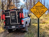
Fires are a major concern out west when compared to the forests back east. The trails were different, we were at much higher elevations (5,000-7,000 feet), and there were somewhat different concerns. All I can say is just be responsible out there, be sure you completely extinguish all fires, and pack out your trash. Burning plastics and metals in a fire is not disposing of trash in a responsible way. Many of the fire pits we came upon had garbage in them. I am not tree hugger but I don't think its asking too much to at a minimum, leave an area in the same condition as then you arrived.
SED 08.jpg

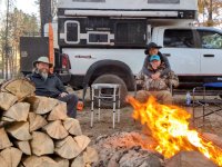
One of the nicest things was to come upon camp site surrounded with downed trees just begging to be cut up and split. We had so much firewood we left quite a bit for the next adventurer. Dennis has an electric chainsaw which I am totally sold on - maybe if they have a sale soon I will finally pick one up. After cutting the logs I took off my shirt and began grunting a performing that strange male ritual where we swing heavy things with a sharp end and make big chunks of wood into smaller pieces. It really felt good swinging my Fiskars X25 Splitting Axe and blowing apart wood.
SED 09.jpg

My final picture was taken at a spot where I stopped on the trail and watched Dennis and his wife disappear into the distance. First I lost sight of them, then the sounds they were making were absorbed by the silent forest, and then they were gone. It's nice to be in a group in the forest but then again, it's also nice to be alone. I enjoy stopping at a beautiful place and catching up later. This moment was so peaceful, so beautiful, so natural, so...real. The picture you see is an electronic image - it is false. The reason you will never feel the same feeling I felt when I was alone in the forest is because it is impossible. I can share pictures, tell a story, but all of that falls short.

I take these photographs and write these paragraphs to inspire others to begin truly living life. I hope my children will someday stumble upon this collection after I am long gone, and they may decide to visit the same places, and feel the same feelings. For the average person you have approximately 4,000 weeks of life to live. How many do you have left and how will you spend them?

I have decided to live life and ignore the false promises of the ruling class...
SED 10.jpg
 
Last edited:

ramblinChet

Drinks Alone
Joined
Dec 24, 2020
Messages
476
Reaction score
1,937
Part 2 of 2

This is a continuation of my previous post on the Sedona Backcountry Trail.

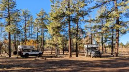
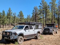
At this point we were approximately half way through this 250+ mile trail and really enjoying the adventure. We were still in the Kaibab National Forest and it was easy to find camping spots large enough for both of our trucks and wood was plentiful. The nights were just slightly on the cool side so a fire was perfect. We had initially planned to meet in Arizona in September but my schedule forced us to slip to November which we both felt was really pushing the limits of good weather. As it turned out, the first few weeks of November were absolutely perfect temperatures during the day and night.
SED 11.jpg

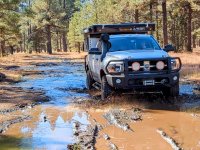
I was our lead navigator and I used Gaia GPS on my factory Uconnect 4 with 8.4" touchscreen. The map layer I use most often is the Gaia Topo and one of the details I like is the fact it shows the locations of springs. Although the trail had been dry we encountered this wet area near a spring so I took the opportunity to assess the conditions and drive through in two-wheel drive without spinning an all-terrain tire. Dennis was running a hybrid AT/MT and opted to engage his Atlas transfer case and crawl through without slipping either.
SED 12.jpg

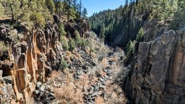
We stopped by Sycamore Falls for a short hike and sightseeing. The geological formation here was much different compared to what we had been experiencing the past several days and was a pleasant surprise. During my adventures I always make an effort to schedule in short hikes each day although I have much room for improvement. Navigating a trail for most of the day coupled with breaking down and setting up camp, add in a few meals, and maybe a stop here or there...exploring can become busy. My target goal is to incorporate a total of one hour of walking in per day.
SED 13.jpg

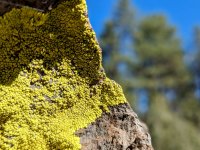
Amidst all the grey rock and brown trees was some interesting green growth on a few of the rocks in the area. It stood out to such a degree that it appeared to be out of place in the midst of everything else. With the sunlight hitting parts, this bright color was quite attractive. Again, the seemingly randomized natural beauty of nature simply can not be duplicated.
SED 14.jpg

Here was a mistake in the making. We had been on relatively flat roads for quite some time and Dennis wanted to spice things up after lunch so he selected a four-digit forest service road to have some fun on. While talking over our radios I made sure to confirm that based upon my map, this was a high-clearance 4x4 road and looking out in front of me, it was barely visible and appeared to be unused for an extended period.

I suggested Dennis lead if he wanted to tackle this trail and early on all seemed fine. It didn't take long until it began to become a guessing game of where the actual trail was and I began to feel a bit uncomfortable. A short time later Dennis halted forward progress and stepped out to scout ahead - I jumped out also and after searching high and low, it appeared that we had wandered slightly off of a seldom used trail. Dennis spotted a connecting road just a hundred meters or so away but it would be necessary to clear a path of some small trees and bushes. I strongly suggested that our best choice was to double back and get out the same way we came in. It was longer but I was against cutting or running over anything unless it was an emergency. We had made a mistake exploring this trail and it was long past the time to correcting it.
SED 15.jpg

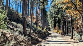
Continuing south we dropped down into the Prescott National Forest and were simply stunned by the rapid change in scenery. Within just a few hours we went from a forested area to wide open high-desert where everything seemed to be miles away. Honestly, if you are looking for one trail which will show you the many different faces of Arizona, I would recommend the Sedona Backcountry Trail be placed on your short list. Along this part of the trail we enjoyed shelf-roads and stopping into the former mining town of Jerome complete with a nearby ghost town.
SED 16.jpg

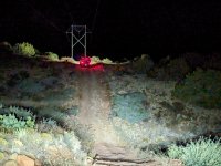
Here we are running the power lines north of Cottonwood, Arizona late at night. If you are interested in this trail I would strongly suggest you top off your tanks in Cottonwood as there no more opportunities to fuel up until you arrive back in Sedona. It was fun to travel at night and exercise our off-road lights although the reason we were traveling so late was not planned.

When we stopped to fuel up I began talking with a German family (ourlifeisaholiday) exploring these United States in a really cool vehicle. It is common for me to strike up conversations although this time was somewhat different since Dennis and his wife elected not to join in. Dennis departed after mentioning they were "heading to the first place on the right that we saw driving in" for dinner and I figured I would catch up in a few minutes. Minutes later I departed and drove to the location Dennis mentioned and they were not there so I called out on the radio and received no reply. After a few more attempts I tried calling Dennis' phone but there was no answer. I then began driving up and down the road we came into town on, stopping at every restaurant, and still was unable to find them. Finally, with very broken communication on the radio I continued to repeat "phone." Dennis had left his phone in his truck and they decided to go to a restaurant in another part of town. Dennis heard me say "phone" so he retrieved his phone, called me, and communications were reestablished.

To make the evening even more interesting, when we began to head north out of Cottonwood, all of the former disbursed campsites along the trail were marked closed along with threats of significant fines. After hours of driving we ended up parking in an approved large dirt parking lot in the middle of the desert with thirty other freedom lovers. Over the years, as this lifestyle grows, it is clear to me that our corrupt politicians and dysfunctional government bureaucrats are continually closing down camp site, access roads, and prohibiting human travel in natural areas.
SED 17.jpg

The next day most the trails were sandy and fun - we could tell we were closing in on Sedona when we began to see those beautiful red rocks, pink Jeeps, side-by-sides, etc. A nice place to stop for lunch was the Honanki Heritage Site which was more or less stones piled up near a mountain. While reading the descriptions of these "complex societies," I often consider other advancements in other areas of the world such as mechanical clocks, massive churches with stained glass, books, etc. What's so complex with regards to stacking stone and packing them with mud?
SED 18.jpg

As we closed in on Sedona there was an optional spur for high-clearance 4x4 vehicles called Devil's Bridge that ended at Vultee Arch. It was a fun trail but keep in mind that since it is close to Sedona there are many other users to include pink Jeeps, side-by-sides, hikers, etc. The trail was busy and although it was fun, it was a bit too crowded for my taste. Of course, the more crowded a trail is, the more dust there is and with the sun setting, vision can be obscured. Mix that with folks on vacation renting a side-by-side and you can see where I am going - it's a tough call but I ran with my lights on and kept a slow pace.
SED 19.jpg

We successfully completed the Sedona Backcountry Trail in four days which I consider an absolute minimum. Six or seven days would have been perfect although Dennis only had a few weeks and we wanted to knock out a number of trails together in Arizona. If you have a 4x4 vehicle you should be fine on 99% of the trail and if you come to an area that is too challenging, there is often a go-around. I must admit, it was quite fun driving an AEV Prospector into old mining towns along the way.
SED 20.jpg
 
Last edited:

ramblinChet

Drinks Alone
Joined
Dec 24, 2020
Messages
476
Reaction score
1,937
While searching for camping spots with flush toilets and hot showers you might have guessed that this naturally excludes disbursed camp sites that have no electrical or water hook ups. Since I plan on spending the winter here in the south-west and some of that time may be in campgrounds where my only choice is to pay for a site with electric I might as well take advantage of the power provided to keep my house battery charged.

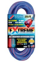
On that note I performed some research and decided to purchase an extension cord manufactured by US Wire. It is a 12-gauge 25-foot rated for 15 amps at 125 volts and has a SJEOW cord jacket rated for used from -94° thru 221° Fahrenheit. Here are some of the manufacturers notes:

All US Wire cord sets are double insulated - individually insulated conductors surround by an outside jacket - with solid molded plugs. Outer jacket will not mar floors or walls and is resistant to abrasion and deterioration from moisture and sunlight.

The EXTREME All-Weather Extension Cord is constructed of 100% TPE (thermo-plastic elastomer) compound which allows the cord to stay flexible in the most extreme climates without effecting the cord's performance.

Furthermore, the TPE compound provides a lightweight, tangle-free construction to the EXTREME cord, not commonly found on most standard PVC cords. Tested in some of the harshest weather conditions in Alaska, the EXTREME All-Weather Extension Cord is designed for durability to last a lifetime.

US Wire 2.jpg
US Wire.jpg


I also watched this informative video while performing my research:


ramblinChet

Drinks Alone
Joined
Dec 24, 2020
Messages
476
Reaction score
1,937
A pliable extension cord is worth all the extra monies, just like the black rubber garden hoses for the house.

It's funny you mention that - back in the 90s I purchased two Craftsman black rubber garden hoses with brass connectors. Still have them both and they look and function like new!
 

flan

Well-Known Member
Joined
Aug 16, 2019
Messages
3,445
Reaction score
6,827
It's funny you mention that - back in the 90s I purchased two Craftsman black rubber garden hoses with brass connectors. Still have them both and they look and function like new!
Craftsman was the best, not sure if they still make them though. Goodyear tried to make them (we had them at work) but just weren’t the same as the craftsman.
 

ramblinChet

Drinks Alone
Joined
Dec 24, 2020
Messages
476
Reaction score
1,937
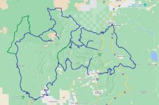
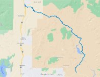
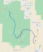
Our next trail in Arizona was the Bloody Basin Trail which is a 36-mile out and back trail that should only take a single day. We decided to extend the trail and continue south to create a one way 57-mile trail which took us two days to complete. In summary, most folks stop at Sheep Bridge on the Verde River and then turn around. We decided to spend the night on sleeping on the river and then when we woke up we decided to continue south until we hit pavement. The map below displays out complete 57-mile route. PM me for the complete KML file.
BBE 01.jpg

The Bloody Basin Trail begins just off Interstate 17 (exit 259) just north of Phoenix at the entrance to the Agua Fria National Monument. Dennis located a great dispersed camp site right near the beginning of the trail so we basically woke up, enjoyed breakfast as the sun slowly rose, and hit the trail for another awesome day filled with adventure!
BBE 02.jpg

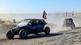
Since this "appeared" to be a short and easy trail we were not in much of a hurry and early on we stopped by Pueblo La Plata Cultural Site to explore the ruins. Earlier, we noticed many nearby dirt parking lots were filled with tow vehicles and side-by-sides. These vehicles are optimized for high speed travel over rough terrain so it was not unusual for us to pull to the side so groups were able to pass. What we didn't realize is that only the first five miles of Bloody Basin are maintained and beyond that the road becomes rough and progress slows significantly.
BBE 03.jpg

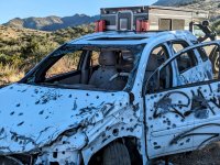
Miles later when we began to hit the rough section that would extend until the end we began to notice the toll the rough road took on other vehicles. We took notice of three broken vehicles along the way. This one was abandoned after being used in a training exercise for vehicle ambushes - just kidding. Miles later a full sized truck was pulled off to the side of the road with the front end on jackstands and one of the front tires removed. It appeared the front axle shaft had broken and my guess is the owner would return soon to complete the repair. Another newer SUV was pulled off to the side and buried in the sand with large parts strewn about - like the rear hatch assembly.
BBE 04.jpg

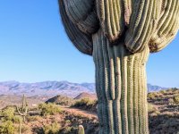
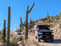
Spending time along the border in Texas I am accustomed to seeing Prickly Pear Cactus but this might have been the first time I came face-to-face with Saguaro Cactus. Here I was out in the desert, acting like a child - looking at these strange plants and wondering all about them. Maybe it was watching the Road Runner and Wile E Coyote in "Cactus If You Can" or "The Duke," John Wayne in El Dorado, but I think cacti are pretty cool.
BBE 05.jpg

Near the end of the day we came upon the Verde River deep in the Tonto National Forest. Since the ride in was much slower than anticipated we decided to unpack and spend the night at this location. I noticed an area across the river that looked great as a campsite so I took the opportunity to cross and scout the area.
BBE 06.jpg

Early the next morning I decided to take a walk before breakfast and enjoy the sunrise. The night before a family had been on the shore fishing and listening to music together. It's always nice to see parents and their children out having fun in nature. One of my biggest regrets as a young father with a stay-at-home mother was working far too many hours believing I was doing something good for my ex-wife and children. I deeply regret not breaking away earlier from the work and consume mentality and not just taking my family out into the wild to live and play. If you have a family, and especially children, get out and explore the outdoors this weekend. Just do it.
BBE 07.jpg

The road south of Sheep Bridge on the Verde River was quite smooth and travel was fast and easy. And for those who are curious, yes - the bridge was built around a century ago so sheep were able to cross the river. Here is a shot with my AEV Prospector in the lead and Dennis' Power Wagon picking up the rear amidst a sea of cacti.
BBE 08.jpg

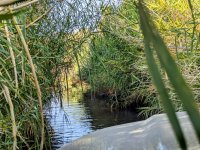
Near the very end we had one final water crossing which was shallow but interesting. For just a minute it felt like I was crawling through a jungle. The plants were not heavy and it was almost like they were cleaning away the dust prior to us jumping back onto the paved road - it was a nice ending to two wonderful days of exploration.
BBE 09.jpg

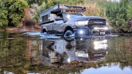
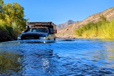
Here is one final shot of me playing in the Verde River. Remember to scout a river crossing prior to attempting - taking your trousers off and getting your legs wet is a small price to pay compared to a hydro-locked engine or a vehicle totaled because it was submerged. Brief the crossing and have recovery gear readily available - only cross one vehicle at a time. . Shift into low range and use second or third gear to keep your engine RPMs up as you cross at 3-5 MPH. Your goal is to create and maintain a bow wave in front of you while crossing. When your crossing is complete, inspect your vehicle for any water intrusion.
BBE 10.jpg
 
Last edited:

ramblinChet

Drinks Alone
Joined
Dec 24, 2020
Messages
476
Reaction score
1,937
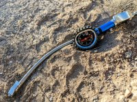
This is what an ARB tire inflator looks like after being driven over at camp. The inflator was part of an ARB twin motor portable 12v air compressor and was left on top of a tire while breaking down the compressor, wrapping up the air line, etc. Unfortunately, none of us noticed and as we were departing camp, the inflator rolled off the tire as the vehicle backed up and was driven over. Surprisingly, the inflator still works as advertised and that includes the bent gauge.
BBE DEN.jpg

Since I am in the process of designing and installing a complete onboard air system I though this would be a great time to make my final decision on some of the components and place orders. My goal is always to strike a balance between rugged industrial parts, their associated prices, and how much do I really require the heavy duty parts. By default, I lean towards the safer side of any decision since I never know where I'll be in a year.

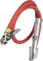
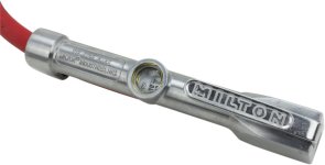
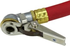
With that in mind I selected a Milton Single Head Air Chuck Inflator Gauge. If you have spent any time in an industrial setting or automotive garage it is highly likely you have seen one of these. It has a full swivel chuck head so it will clip on to the valve stem and I also selected this specific one with a three-foot hose so I am able to stand near the tire as it inflates. As I grow older many of my injuries from my younger years are becoming increasingly worse so I am doing my best to preserve what still remains.
MIL 00.jpg

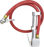
Look at that beautiful heavy duty EPDM rubber hose which two braids for kink resistance and will remain flexible in extreme temperatures. Maximum working pressure is 250 psi and burst pressure is 1,000 psi.
MIL 01.jpg

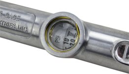
The internal gauge ranges from 10-160 psi in two pound increments. This will easily put me in the ballpark and then I will use my Longacre Racing Products Magnum 3-1/2" tire gauge for final adjustment.
MIL 02.jpg

I am not much of a fan of gauges on air inflators but I expect this one will be just fine for my application.
MIL 03.jpg

Here is that magnificent 7/16"-27 TPI UNS single head grip air chuck. I strongly considered the Kwik Grip Safety Inflator Gauge although while researching the product I found many examples of the chuck only being useful on exceptionally long tire stems.
MIL 04.jpg

While perusing the Milton site I also searched through their many blow gun options and decided on this Safety Blow Gun and 10" Extension. When I pull into a camp site after spending 100+ miles on a dusty trail it is very nice to use onboard air to blow the dirt and dust off the rear of the camper. Another use is opening the rear door and blowing out sand and dirt off the floor of the camper. There are many other models ranging from four to fifteen inches. She gets all excited when she begs for my big ten inch.
MIL 05.jpg

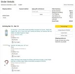
Receipt for records.
MIL REC.jpg
 
Last edited:

Chrisminx

Well-Known Member
Joined
Nov 12, 2020
Messages
656
Reaction score
934
Hello again Texas! On my way to spend the winter in the south west I decided to have some fun and combine two trails into one larger one. The first is known as South Cotton Lake Road to SHNF (120 mi) while the other is the infamous Cheeseburger Loop (170 mi). This should have provided me with 290+ miles of fun in east Texas along with some quality time in Sam Houston National Forest. If you suspect things did not go quite as expected, you are correct. I am simply happy I did not end up being shot or thrown in jail. My lesson learned is that I must perform more research before downloading a GPX file and hitting the trail.

The southern half of South Cotton Lake Road to SHNF from Beach City to Cleveland, Texas, was mostly paved roads, contained a few errors, and locked me into an uncomfortable situation. Just north of Cleveland you will immediately jump into the Sam Houston National Forest so I would recommend adding that to the Cheeseburger Loop if you are coming up from Houston.

Dark blue is South Cotton Lake Road to SHNF whereas medium blue is Cheeseburger Loop.
View attachment 64993

This is northbound on Texaco Road where it breaks off FM686. Of course, I always enjoy traveling at night in unfamiliar places, and to add a bit of excitement, I passed through a gate with a dozen locks and about as many "NO TRESPASSING" and "PRIVATE PROPERTY" signs hanging on it. Most of the property in Texas is privately owned although many of these same properties have public easements or roads which pass through which are perfectly legal to drive on.
View attachment 64994

It is possible that either I am wrong or some of the land owners feel differently since occasionally you come across a locked gate which technically is prohibiting use of a public road. I need to perform more research on this subject so I keep myself out of trouble but this evening went from bad to really bad in within thirty minutes. In short, I passed through an unlocked gate, drove two miles north, then drove another two miles to the east and came upon a locked gate. I then decided the best thing to do would be to drive back out and find a go around. Unfortunately, when I returned to the gate that was previously unlocked, it was not locked. It was around 2100 local, I was locked inside an area with mostly grassy roads and the occasional dirt one.

I stopped my vehicle and though about what I was doing and began trying to come up with a plan to get back to a main road. It was confusing that the gate that was unlocked maybe thirty minutes earlier was not locked and I was not sure if someone working had left or if someone was aware that I was on the property and was planning to confront me, or was calling local law enforcement. I was sure this was a public road but then again, I was locked in. Here is an example of a gate that I found on the north end of Texaco Road where it crosses a canal and then turns west. It was unlocked although the map showed this road being a dead end.
View attachment 64995

Here are some of the "roads" I began to explore while attempting to escape. I wish I had taken other pictures but I it was getting late and my primary mission was to get back onto a paved public road. While exploring I came upon what appeared to be an abandon grain storage facility (30.10116881152415, -94.96113447759215) that was dilapidated and surrounded with old tractors that themselves were overgrown with weeds. It looked pretty bad since every road I explored ended up with a locked gate or it was impassible.

Fortunately, I happened upon a place where I reclusive man lived - I turned off my bright lights, honked the horn, and when he came out I immediately said I am trying to get back to the main road and all the gates were locked. I felt bad when he said he could see the bright lights roaming that fields and he was scared because he was not sure what was going on. This man was kind and understanding and after I explained my predicament he shared with me a way to sneak out where there was no gate. In the end I drove east across a large field towards a farm and did not feel too comfortable doing what I was doing, but I saw the pavement ahead and got out of Dodge!
View attachment 64996

This is the beautiful Shell Road Hunter Camp just north of Cleveland, Texas. A few local trucks circled through early in the morning and then local law enforcement did also but no one gave me any problems. It is a large flat area with enough room for at least a dozen vehicles to park. It felt good to know I was in a National Forest at a legitimate camp. The entire scenario which had me locked in was still confusing and my lesson learned was to try to stick to more commonly explored trails while performing additional research.
View attachment 64997

This is an example of me coming upon an accident out in a rural area which took place just as I was driving up. As soon as I realized what happened I slowed down, kicked on my four-ways, and began to slowly approach the scene. As I was pulling up a few other trucks appeared from two other directions and by the time I parked and got out, they were already hooking up a strap and ready to pull the car out of the ditch. The girl was out and walking around and even though air bags were deployed she said she was fine and did not require any medical attention. Within a minute or two the car was pulled out and phone calls were being made. It all happened a bit too fast for my liking but I was not in charge.

A lesson learned long ago it that when something bad happens it is common for folks to set their own safety aside and rush in only to make matters worse. This is why I purposely slow down the process and make many observations before entering an accident scene. A good thing is that I had a winch, full recovery kit, and fire extinguisher available. I failed through since I do not have a basic medical kit on board with me. I must perform some research and pack one in my cab just in case.
View attachment 64998

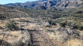
Here is a shot from the eastern section of the Cheeseburger Loop while traveling through the Sam Houston National Forest. This was a really nice area and perfect time of the year.
View attachment 64999

Another well maintained road that was part of the Cheeseburger Loop. I am not sure who at Adventure Riders was responsible for this loop but it is a nice one. If you download the GPX file make sure to select the most currently on that can be found here.
View attachment 65000

The western half of the loop is mostly farm country - still some beautiful riding. I like how the east half is in the forest with trees while the west half open up to farm country and that big Texas sky. There are also approximately four fuel stops equally spaced around the loop.
View attachment 65001

Here is why the trail is named Cheeseburger Loop - it's because of Yankee's Tavern and more specifically, their famous 1/2 pound Wide Glide burger which is "served on our signature jalapeno bun topped with crispy bacon, three different types of cheese, and finished off with grilled jalapenos, mushrooms, and onions. Perfectly paired with an order of our tavern chips." It does not get any better than this men and the sisters behind the bar were collared and dressed to kill. The funny thing is, that is not how they normally dress, it was Halloween and I had no idea. The burger and service were great though and so was the trail.

For me, the entire trip was 305 miles long and took 10.25 hours for an average speed of 30 mph. If you are in the Houston area or just passing through on Interstate 10, head up to Cleveland, jump on the last half of South Cotton Lake Road to SHNF and knock out the Cheeseburger Loop. Do not attempt this at night and make sure to think twice before passing through a gate with locks that is covered with signs.
View attachment 65002

I wish I would have seen this a month ago. You were in my area. ‍
 

ramblinChet

Drinks Alone
Joined
Dec 24, 2020
Messages
476
Reaction score
1,937
In out next adventure we combined two nearby trails: Crown King Road and Senator Highway which add up to a combined 64 miles and will take a full day. We were nearing the end of Dennis' time in Arizona so we wanted to select a few shorter trails that were easy to mild to minimize the possibility of damage and provide the option to jump off the trail if time was running short. Dennis originally wanted to incorporate another trail names Backway to Crown King but after I spent time reviewing the trail we met in the morning and I suggested we drop it since it was the roughest of the three, the condition of the trail varies due to use, and since it was the weekend, we should expect to see much traffic. Dennis agreed and we cut this one section out.

In hindsight, if I were driving north from Phoenix and had two or three days to make it up to Prescott, I would have begun on the southern end of our recent Bloody Basin Trail (extended), maybe camped at the Verde River or pressed on and camped near Interstate 17, the then continued on with Crown King Road and Senator Highway. That would have been a really fun 120 mile, two or three day adventure!
CKSH 01.jpg

We arrived at the trail head near sundown so we found this place to camp nearby and tucked in for the night. Dennis had a paperback book which contained much information related to BLM camping in Arizona so within a few minutes he located a spot nearby and we climbed up and over a few small hills and found a nice little spot. As the sun fell and the stars began to shine it appeared in the distance that a few other campers were also enjoying the area.
CKSH 02.jpg

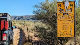
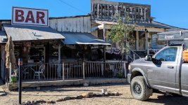
The first few miles of Crown King Road are paved and then it transitions into a maintained dirt road. This was a significant relief compared to the rocky and rough Bloody Basin trail where our trail speed was always just a few miles per hour. The first small town we happened upon was Bumble Bee which began as a stage coach stop between Phoenix and Prescott. Despite gold being discovered nearby the small town never really amounted to much. I suspect the problems associated with native Americans who were "thick as bumble bees" made have contributed to it's short life.
CKSH 03.jpg

Around the halfway point on the trail you will roll into another ghost-town named Cleator, which was originally named Turkey Creek. The name changed over a century ago when the town became the property of James Cleator who ran-away from his home on the Isle of Mann as a boy and sailed to these United States on a Spanish ship in 1889. As a former superbike racer, James' home has a very special place in my heart since it is site of the most dangerous race in the world: The Isle of Mann TT.
CKSH 04.jpg

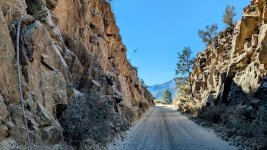
Several miles outside of Cleator you will begin to climb a series of switchbacks which lead you up through the Bradshaw Mountains. Keep in mind there are still operational mines in the area and don't be surprised if you encounter several standard dump trucks. Some of the sections of road are narrow and although general trail courtesy suggests that those climbing, by default, have the right-of-way, there may be times where it may be easier for one or two vehicles climbing to pull aside for half a dozen larger vehicles who are descending. In short, use good judgement, show respect, and enjoy the adventure along the track of "Murphy's Impossible Railroad!"
CKSH 05.jpg

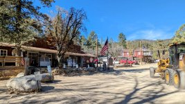
And then we arrived in the small mile-high town of Crown King which rewards you "with a look back into the world of a late 19th and early 20th century mining town, with weathered timber cabins, abandoned mines, deserted equipment, a fading cemetery, a living old-time general store and saloon, and, with good luck, a thousand tales about the good old days." We arrived well before lunch with full bellies so although we really wanted to enjoy a meal at the historic Crown King Saloon & Cafe, this will just be another one of those places to visit again. This small town also has cabins to rent and looks like a fun place to cool off on a hot weekend.
CKSH 06.jpg

Traveling west, just outside of Crown King, we began our journey on the Senator Highway, which was originally constructed as a toll-road in the mid-1800s. This trail has a few more challenging spots, it generally narrow, and was quite a bit more fun when compared to the smoother and faster Crown King Road. And she was a beauty since the scenery changed so dramatically withing just a few miles. This was a fun trail where I noticed a number of great looking dispersed camp sites just off the trail. We stopped at one, pulled into the shade, and relaxed to enjoy a peaceful lunch.
CKSH 07.jpg

While navigating the trail we crossed paths with a dozen vehicles associated with the Kenda Tire Boot Camp and stopped to talk with several of the teams. We discussed trail conditions with the typical, "tell me your past and I will tell you your future" sort of information exchange while also taking tires. Heck, when you have key leadership from the company along with one of their sponsored racers, and a few dozen dealers, why not ask questions and learn a bit! After completing the Senator Highway these men would continue due south to tackle the aforementioned Backway to Crown King.
CKSH 08.jpg

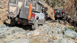
This is one of the few quasi-technical areas we encountered along the trail. As usual, I slowed down, picked a good line, and crossed in two-wheel-drive. It was a bit tougher then what the pictures show but not really that tough - just one of those areas that forces you to think for a moment.
CKSH 09.jpg

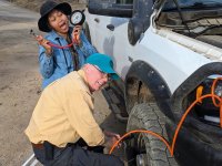
And here we are near the end of the trail airing up tires since the remaining few miles are paved and we planned to roll up into Prescott for a nice dinner. Dennis and I always poke fun at each other regarding our vehicles, components, etc. Years ago I purchased a Longacre Racing Magnum 3-1/2" Tire Gauge. A year or so ago Dennis fought back by purchasing one of their Pro Precision 4-1/2" units so every time I ask him on the radio if he is still running 35" tires still and would like to try my 37s on for size he asks how I am able to read my tiny 3-1/2" gauge and if I would prefer to use his "pro precision" 4-1/2" unit. A few hours later I met Dennis and his wife at Rosati's for some good Italian food.

I want to take a moment to point out that when I began this adventure I began alone. Along the way I have met many others who are also alone, and searching. But more importantly, many of us have met one another along the way and become really good friends. We come from different parts of our planet, we speak different languages, but we all share a common, somewhat primitive desire...to adventure, to explore, to wander. For those that may have missed this romantic piece in the past, I am asking you now to take a few moments and watch this story about you, and me, and our other friends, all wanderers...
CKSH 10.jpg
 

ramblinChet

Drinks Alone
Joined
Dec 24, 2020
Messages
476
Reaction score
1,937
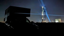
So there I was sitting in a parking lot in Prescott, Arizona, after enjoying a nice dinner with fellow adventurers and my phone rang. It was late on Tuesday night but I recognized the name calling and was sure this was an important call so I answered. "Chet, it looks like IFT-2 (Integrated Flight Test Two) is a go for Friday morning. Everyone is down here and I am confident she will fly, where are you?", said my buddy Tim. Before Tim finished talking I was already pulling up navigation software and plotting a route from Prescott, Arizona, to Starbase, Texas. I replied, "I am 1,400 miles away and just finished two weeks of trails with Dennis and my plan was to remain in Arizona for the winter." By the time the last few words rolled off my tongue I had already began my journey to Starbase.
After working at NASA Langley Research Center, attending the last few shuttle launches, and watching IFT-1 explode over my head, I was unable to resist. No, it didn't make much sense to most folks but I have always been unconventional in so many ways, and I love every bit of living this way. Two days later I rolled onto Boca Chica Beach and sat silent as I listened to the wind and waves, and gazed up at Super Heavy Booster 09 with Starship 25 stacked on top. As I melted into the sand my eyes became so heavy they closed one final time - the song being played in my head was one my late father, Chet Sr., introduced me to so long ago, it was perfect for a night like tonight...
image000000(119).jpg

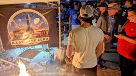
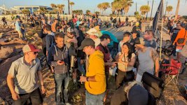
Of course, when thousands of space-geeks from around the world converge for a historic even such as this, there are parties. I was invited to attend the party at Base Camp Zero by Calvin, the originator. My relationship with Calvin is an interesting one - when we first met in March he was somewhat on the shy and reserved side. After watching me interact with mostly women passing by he was shocked at how I initiated conversations, called their bluffs, and generally had a great time making friends. Calvin took my energy and multiplied it by one-thousand times - everyone who visits Starbase searches for Calvin now. He is an amazingly generous man who hands out gifts to everyone.
image000000(120).jpg

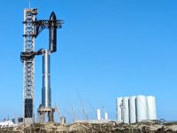
The night prior to the first launch attempt we received unfortunate news, the initial launch attempt was scrubbed following last minute testing. One of the grid-fin actuators has a potential issue to what did SpaceX do...something that NASA would never consider. They immediately destacked the ship, removed critical components, and worked through the night to reassemble the vehicle. The launch window for Saturday morning was only twenty minutes so Friday was spent making doubly-sure everything was ready. This is a shot of the "chopsticks" on the Orbital Launch Tower picking up and restacking Starship.
image000000(121).jpg

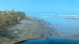
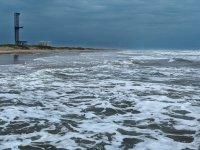
Since everyone was going to be evacuated from the area prior to launch I drove down the coast of the Gulf of Mexico to the mouth of the Rio Grande River which is the border with Mexico. After spending time on the border I turned to head north as high-tide slowly began to roll in. If you plan to spend time traveling on beaches for extended distances make sure to check tide charts so you will not be caught in a compromising position.
image000000(123).jpg

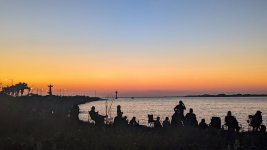
Here we are at first light on Saturday morning at Isla Blanca Park on South Padre Island. This is the best location to view the launch and it is free. Since three in the morning the area was active with excitement as thousands prepared to witness history take place. Off to the left you will see Christ of the Fisherman statue which itself has some interesting history. "Jesus said to them, 'Come after me, and I will make you fishers of men.'" ~ Mark 1:17
image000000(124).jpg

Here are just a few of the Base Camp Zero gang that I spent time with over the past few nights. We had people from Austria, Belgium, Canada, France, Germany, Israel, Italy, Netherlands, etc. During the parties the grill was constantly cooking dozens of pounds of meat and most of the men gathered around to chew on hot pieces of meat using their bare hands. This is a fun group of folks!
image000000(125).jpg

Here is another adventurer I met at Boca Chica who recently completed the 2,600 mile Continental Divide Trail with a group. They should have a really nice video posted in a few months so I will be sure to share it. It's always fun to connect with others at random times and locations. The secret is - get out there and explore!
image000000(126).jpg

Here's a little tip for fellow Four Wheel Camper owners: on the morning I was preparing to depart the winds changed ninety degrees and began to hit broadside. I will not go into how to calculate wind loads across flat roofs but let's just say it is sometimes impossible to close the roof while experiencing broadside winds. My solution was to pull forward, point my ship into the wind, secure the front and then move around to the back, and finish up with the sides. Like we used to say in the military, "work smarter, not harder."
image000000(127).jpg

The launch tower is empty once again and foul weather rolled in to stay several weeks. The team at SpaceX were successful in completing the launch within that twenty-minute window on Saturday morning. Well done...it was one hell of a show and worth everything it took to get there. Some things in life make no sense but are so very worth the time and effort. Do me a favor, pick something small that you have been putting off for a long time. It may not make much sense to complete it right now but do it. Smile and enjoy completing a task and lightening your burden. Pick the next lightest and then the next. Complete the easy ones first and build momentum in your mind so when it comes to some of the larger and more complex ones you will have so much momentum behind you, nothing can stop you.
image000000(128).jpg

In closing, turn down the lights, turn up the resolution, and put some nice headphones on...

 
Last edited:

ramblinChet

Drinks Alone
Joined
Dec 24, 2020
Messages
476
Reaction score
1,937
Why do beavers build dams?

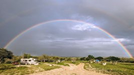
I was listening to a recent discussion where a baby beaver was rescued and despite never spending time with other beavers, began to build a dam. The people discussing this were shocked and amazed - I was not because I know full well the all living things are born with programming already installed. In my mind, that is a great segue into why humans naturally feel so good when they see a rainbow. Here at camp a rainbow recently appeared and everyone stopped to talk and stood smiling at this beautiful sign.

Why are people people programmed to smile and feel good when they see a rainbow appear? I firmly believe it is because of what a rainbow represents to everyone - it represents a bridge, a connection, the fulfillment of a promise...a rainbow represents hope. Many groups over the years have attempted to usurp this divine connection between God and His people although I have nothing to fear. I just smile and share Genesis 9:17 with others smiling around me.
UD 01-01.jpg

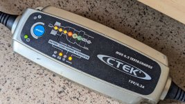
The last month has been really hard on my house battery in my camper. In an effort to control costs I have been spending much time camping in the same location in the desert along the border in south Texas. Unfortunately it has been overcast the majority of the time for the past month so my 200-watt solar system has not been able to maintain my 70 Ah house battery. Lucky for me I have this wonderful CTEK MUS 4.3 Test and Charge that was purchased around a decade ago and the gazebo here at camp has electrical hooks up. I parked nearby and plugged in to recondition and recharge my battery and all it working very well right now!
UD 01-02.jpg

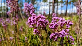
I have been speaking with a good buddy Paul over the past week and he decided to attempt the 500+ mile Panhandle Adventure Trail alone. The following four pictures are ones I originally planned to use while telling my story, but did not. These were just some pretty plants I came across in Tate's Hell.
UD 01-03.jpg

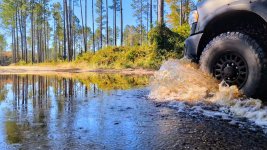
This was one of the countless puddles I navigated in the Apalachicola National Forest. If you like playing in water, hit some of the trails in Florida!
UD 01-04.jpg

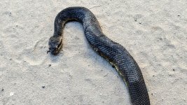
Here is a closeup picture of a Cottonmouth which is also known as a Water Moccasin. This is another type of venomous viper that can be found near water swimming, hanging from a tree limbs, or basking in the sun on rocks. It takes quite a bit to provoke a Cottonmouth so there is no need to worry. If it coils up and opens it's mouth you will see the white interior and also know its time to back away. The more you educate yourself on any given subject, including snakes, the less afraid you will be.
UD 01-05.jpg

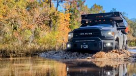
This is similar to a picture I previously posted and I am happy to share it because I had a tough time deciding which one I liked better. The Panhandle Adventure Trail was really fun and I am looking forward to returning to complete other trails in Florida next year.
UD 01-06.jpg

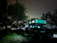
Here I am preparing for another night of restful sleep here at camp. A large part of my journey includes improving myself mentally, physically, and spiritually. I am just like most every other man out there and life has been a roller-coaster. That's okay though because no life is perfect no matter how they appear. I guess that is the massage I wish to share with you in this post - I'm just like you in so many ways. Every man needs a bit of adventure and as men many times we place ourselves into situations where we consciously place the needs of others ahead of our own. So we wake up early, work long hours performing dirty, dangerous, and sometimes deadly jobs. We don't ask for much yet some of our most basic needs are often ignored. If you feel like that, take a moment to communicate with someone who will always be there for us no matter what our situation may be.
UD 01-07.jpg

Here is my buddy Paul's video covering the first section of the Panhandle Adventure Trail - I think this video is great and he really knocks it out of the park near the end. Well done Paul!


ramblinChet

Drinks Alone
Joined
Dec 24, 2020
Messages
476
Reaction score
1,937
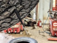
Earlier this week, while continuing to explore the border between Texas a Mexico, I stopped for lunch in the small town of Zapata, Texas. For the past few weeks I have been experiencing occasional loss of pressure in one tire and although it usually only drops around 10-15 psi and the tires are due for replacement in the coming months, I decided that a professional repair was in order.

As many of you know, I carry an ARB Speedy Seal Tire Repair Kit for repairing punctures as well as a GlueTread 4x4 Kit for sidewall repair. I have always considered the sidewall repair kit a temporary measure to get off the trail but based upon my recent learning, I now consider the puncture repair kit a semi-temporary option also. I always love learning something new and my recent lesson was a valuable one in how to properly repair a puncture in the tread area of a tire.

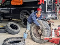
Here is "Shorty" breaking the bead on my BF Goodrich All-Terrain T/A KO2. Since 95% of the residents of Zapata are Latino and the handful of gringos all speak Spanish, he laughed as I struggled to communicate. Within a few minutes we resorted to a more effective communication which involved hand signals and masculine grunts.
image000000(129).jpg

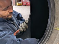
The previous puncture repairs were performed over a year ago at a tire shop and consisted of two plugs and rubber cement being used. What I learned was that the rubber cement glues the rubber plug to the rubber tire but the two pieces of rubber remain independent. More importantly, that rubber cement bond will eventually begin to break down and a slow leak will reappear - this is exactly what happened to me. Here is Shorty prepping the interior surface of the tire with a buffing wheel.
image000000(130).jpg

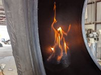
Following buffing, a paste was applied and lit on fire to further prepare the surface for a hot vulcanization process which essentially softens the rubber. Shorty laughed and said "marshmallow" as this was taking place.
image000000(131).jpg

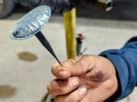
As I learned, this is a lead-wire combination repair patch manufactured by XtraSeal that will be pulled through the puncture from the inside out. This patch will actually bond with the tire on a molecular level and the two pieces of rubber effectively become one. Since the patch is now a permanent part of the tire there is no chance for a bond to break - because there is no bond. This is very cool to learn!
image000000(132).jpg

Here is a final shot of the patch installed just before trimming to length. Shorty did a fantastic job and only charged $15 for each of the two puncture repairs. Over the next few weeks I will begin exploring one of the most remote locations in these Unites States by myself so I am preparing my AEV Prospector for an incredibly austere environment. If you are ever rolling through Zapata, Texas, and are in need of a repair to your tire, I know this guy who really knows his stuff...

Thanks for the lesson Shorty and Feliz Navidad to everyone!
image000000(133).jpg

Note: see U.S. Tire Manufacturers Association Puncture Repair Procedures for Passenger and Light Truck Tires PDF attached.
 

Attachments

  • Puncture_repair_handout_17_2.pdf
    495.6 KB · Views: 2
Last edited:

ramblinChet

Drinks Alone
Joined
Dec 24, 2020
Messages
476
Reaction score
1,937
It has been a number of days since I have had any cellular service or internet connectivity so I would like to wish you a belated Merry Christmas!!!

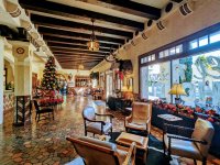
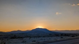
As I slowly work my way to the west I find myself passing through small towns connected by long and lonely roads. The driving is different out here and overall I would rate it as peaceful. You have much time to think and contemplate life as you drive along these never-ending roads. I stopped into one larger town and happened upon quite an interesting hotel named Hotel Paisano, where Rock Hudson, Elizabeth Taylor, James Dean, and Dennis Hopper, stayed while filming the movie Giant in 1956. My guess is one day I will return to the area and stay in one of the rooms. Which one would you choose and more importantly, why?
BB 01.jpg

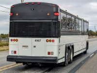
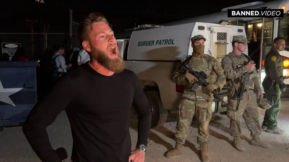
Ghost busses used for transporting illegal aliens and other criminals are unfortunately very common along the border. These are busses with no company or government markings that have windows tinted so deep it is nearly impossible to determine what is inside. If you happen to pass a Ghost bus with the sun on the other side you will notice the interior has been caged to prevent occupants from breaking a window and escaping. If you view a Ghost bus from head on you will notice a wall that separates the driver from the "passengers." Our population and the population of Europa is being replaced intentionally.
BB 02.jpg

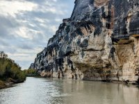
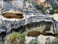
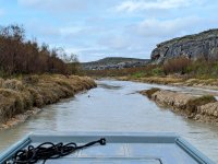
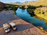
Since I was exploring the border between these United States and Mexico I sometimes end up in places few people have ever been. In this instance I am moving along the Rio Grande River while observing geological formations I never knew existed. For reference, to the right is Mexico and to the left is Texas.
BB 03.jpg

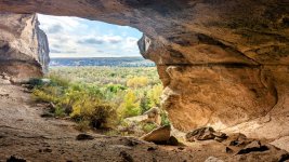
From what I was able to learn, from approximately 7,000 to 4,000 years ago people lived in these dry-rock shelters along the river. These are interesting areas to explore since these shelters also include pictographs which I was able to view up close.
BB 04.jpg

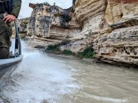
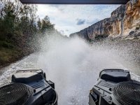
The Rio Grande River confuses me since some areas seem wide and deep whereas others are narrow and shallow. Most of what I experienced on this day was narrow and shallow and when I mention shallow, I am suggesting 6-12" deep in many areas. We were on a custom "mud boat" specifically designed for this type of application. It was not uncommon for us to be moving along and feel a drag on the belly which represented us passing over a very shallow section of the river.
BB 05.jpg

The primary reason we spent the day exploring this section of the river was twofold: testing the real-world effectiveness of this new custom "mud boat" while also conducting a patrol. I won't go into great detail but we covered much territory and I learned quite a bit regarding signals used to detect crossings of animals versus humans. And when I speak of humans, only those with a very strong desire to cross undetected attempt to cross in areas such as these. In short, we were looking for the worst-of-the-worst.
BB 06.jpg

Here is a dry-rock shelter that was so large it would be easy to construct a full-sized home inside of it. We spent well over an hour investigating this particular location since there were signals that other humans had visited in the recent past. Some of the areas explored on the Mexican side were primitive fishing and hunting camps that are still being used today.
BB 07.jpg

When it was time to "get out of Dodge" these men knew what to do and to some degree reminded me of Special Warfare Combat Crewman back home in Little Creek, Virginia. In this shot we are wide-open with only around five feet of water on each side of the vessel and very little underneath. There was one time when I was looking back where we were traveling so fast and displacing so much shallow water that I looked back and saw a trail of mud with water rushing in from each side to refill the void we created.
BB 08.jpg

Life is different out here along the border in the Wild West...
BB 09.jpg
 

jsalbre

Well-Known Member
Joined
Oct 29, 2019
Messages
2,571
Reaction score
3,282
Location
ID
Cool pictures and adventures as always, but I can’t find anything backing up the story about the “ghost busses”. I grew up in south Texas, and came back after I left active duty, and never heard this, and no where I look on the internet corroborates it either. The only thing I can find about unmarked commercial busses is about carrier reincarnation, which is where shady bus operators don’t mark their busses, that way when they have an accident they can just shift them over to another “company” they own, hiding their history of dangerous operation. https://www.atlasobscura.com/articles/the-zombie-bus-scam-that-just-wont-die

As far as I’ve been able to find, the only ones bussing immigrants around the country are the Texas and Florida governors.
 

ramblinChet

Drinks Alone
Joined
Dec 24, 2020
Messages
476
Reaction score
1,937
Cool pictures and adventures as always, but I can’t find anything backing up the story about the “ghost busses”. I grew up in south Texas, and came back after I left active duty, and never heard this, and no where I look on the internet corroborates it either. The only thing I can find about unmarked commercial busses is about carrier reincarnation, which is where shady bus operators don’t mark their busses, that way when they have an accident they can just shift them over to another “company” they own, hiding their history of dangerous operation. https://www.atlasobscura.com/articles/the-zombie-bus-scam-that-just-wont-die

As far as I’ve been able to find, the only ones bussing immigrants around the country are the Texas and Florida governors.

Maybe there is nothing being reported on the main stream media but my suggestion is to take a ride up US 83 between McAllen, Laredo, and Eagle Pass. I saw dozens every day and when you pull into town you see dozens more parked at hotels. And although your story regarding commercial busses and carrier reincarnation sounds valid - this is all about transporting illegal aliens throughout Texas and these United States. The only other time I have had first-hand knowledge and been present to confirm our government actively using "ghost busses" is while working on the farm.

Here is a video with actual footage within the past year:


Users who are viewing this thread

Top