Ram Heavy Duty Forum
You are using an out of date browser. It may not display this or other websites correctly.
You should upgrade or use an alternative browser.
You should upgrade or use an alternative browser.
2021 RAM 3500 Tradesman | AEV Prospector | FWC Grandby
- Thread starter ramblinChet
- Start date
ramblinChet
Drinks Alone
- Joined
- Dec 24, 2020
- Messages
- 477
- Reaction score
- 1,956
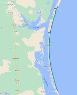
After spending a few days in Corpus Christi it was necessary for me to return and explore more of Padre Island National Seashore. This time my plan was to drive south along the remote beach the full sixty miles. Since I was traveling alone without any cellular service and most of my drive would take place under the cover of darkness, it was necessary for me to perform research and create a plan along with alternate plans just in case things went south.
My primary plan was simple - top off fuel and supplies going in, travel a few hours ahead of low tide, and drive on the foreshore, the wet part of the beach exposed by low tide, for three to four hours without stopping. My goal was to maximize fuel mileage along with my ability to cover as much ground as possible in the shortest amount of time. If I did become stuck at least the tide would be falling and I had several hours to perform a self-rescue. Regarding self-rescue, I have a number of options. My first option would be deflating my BF Goodrich All Terrain T/A KO2s to 15 psi. Secondly, I have four Maxtrax and a shovel available. Next, I have a Warn 16.5 ti Heavyweight winch, AEV recovery gear, and a Deadman Off-Road V2 earth anchor. Some may consider this overkill but keep in mind I explore remote deserts, forests, and mountains that I am unfamiliar with, full time.
Note: GPX file can be downloaded here
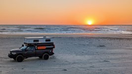
I successfully traveled the full sixty miles and enjoyed watching the sun rise over the Gulf of Mexico at Mansfield Channel. I spent three or four nights camping down here and the fishing was good. My Prospector and camper combo takes me to the most amazingly beautiful locations again and again.
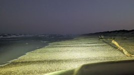
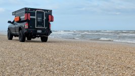
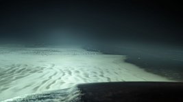
This is a picture from my first night while driving through Little Shell Beach approximately ten to fifteen miles south of Malaquite Beach. Minutes later everything became black and I was happy once again to have an assortment of LED lights available. Good lighting was more important than you might imagine. The wet area I was traveling in was narrow and littered with washed up trees and driftwood. My primary concern was avoiding having a tire punctured by a piece of wood along with keeping out of the soft dry sand which would have significantly decrease my fuel mileage.
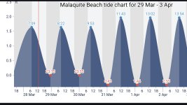
Downloading a tide chart and taking a screen shot will permit you to peer into the future and plan accordingly. If your plans include driving on a beach you must have this. The park rangers are also able to provide you with a print out of upcoming conditions.
Shell Beach - I would have loved to take my children to a place like this when they were younger. Sure, collect as many shells as you would like!
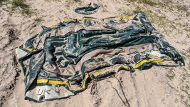
Folks in Texas must be rich - they use life rafts one time and just leave them behind the dunes off the beach. I found four rafts within ten minutes of walking around my one campsite.
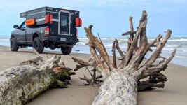
Due to prevailing southeasterly winds from the Gulf of Mexico, much debris piles up here. In one video, Ozark Overland Adventures also discusses the difficulties associated with navigating beach debris and tides at PINS. I once again took advantage of low tides, had no problems, and recommend others to do so also. Becoming stuck out in the middle of nowhere without any cellular service would be a memorable family event though!
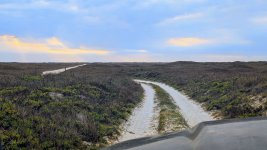
Driving back to Yarborough Pass through the grasslands and tidal flats. When you transition from the beach to this area you must climb over the soft dunes that really require four wheel drive. I may have been able to make it in two wheel drive if I aired down but I was running street pressure. I enjoyed camping back here for several nights.
My adventure at Padre Island National Seashore has come to an end but rest assured, I will return. If you have never driven sixty miles alone down a deserted beach in an overland vehicle and camped for what seems like forever, you may wish to consider a trip like this. It felt as if I had driven backwards in time thousands of years and when I arrived, time stood still.
Initially, I planned to drive the full sixty miles from Malaquite Beach down to Mansfield Channel, spend a night or two, and then head back. I also considered stopping at Yarborough Pass and spending a night camping on Laguna Madre. A long drive on the beach, a few more nights under the stars, check it off and move on. I stayed so much longer. What I didn't plan on was being seduced by the peace, solitude, natural beauty, and rhythmic sounds of the waves crashing and winds gently rocking my popup camper. There's a special feeling you get when you walk through the surf for an hour in either direction and see no one else. There are no man made objects anywhere to be seen - it's primitive, intoxicating, and something you must experience.
Low tide was in the middle of the night and driving at this time in these conditions was a surreal experience to say the least - I drove for hours and my view rarely changed. Although I maintained an average speed of fifteen MPH, a heavy coastal fog raced across my windshield the entire way and since I was driving on the foreshore there were no other vehicle tracks. The sights, the sounds, the smell - what a way to finish off my time on PINS. I'm not the biggest fan of hanging out on the beach but I must admit - this was an experience unlike any other. And make sure to bring a saw and an axe since there is an abundance of driftwood available for a primitive beach fire.
Step back in time, slow down, and live life.
My primary plan was simple - top off fuel and supplies going in, travel a few hours ahead of low tide, and drive on the foreshore, the wet part of the beach exposed by low tide, for three to four hours without stopping. My goal was to maximize fuel mileage along with my ability to cover as much ground as possible in the shortest amount of time. If I did become stuck at least the tide would be falling and I had several hours to perform a self-rescue. Regarding self-rescue, I have a number of options. My first option would be deflating my BF Goodrich All Terrain T/A KO2s to 15 psi. Secondly, I have four Maxtrax and a shovel available. Next, I have a Warn 16.5 ti Heavyweight winch, AEV recovery gear, and a Deadman Off-Road V2 earth anchor. Some may consider this overkill but keep in mind I explore remote deserts, forests, and mountains that I am unfamiliar with, full time.
Note: GPX file can be downloaded here

I successfully traveled the full sixty miles and enjoyed watching the sun rise over the Gulf of Mexico at Mansfield Channel. I spent three or four nights camping down here and the fishing was good. My Prospector and camper combo takes me to the most amazingly beautiful locations again and again.

This is a picture from my first night while driving through Little Shell Beach approximately ten to fifteen miles south of Malaquite Beach. Minutes later everything became black and I was happy once again to have an assortment of LED lights available. Good lighting was more important than you might imagine. The wet area I was traveling in was narrow and littered with washed up trees and driftwood. My primary concern was avoiding having a tire punctured by a piece of wood along with keeping out of the soft dry sand which would have significantly decrease my fuel mileage.

Downloading a tide chart and taking a screen shot will permit you to peer into the future and plan accordingly. If your plans include driving on a beach you must have this. The park rangers are also able to provide you with a print out of upcoming conditions.

Shell Beach - I would have loved to take my children to a place like this when they were younger. Sure, collect as many shells as you would like!

Folks in Texas must be rich - they use life rafts one time and just leave them behind the dunes off the beach. I found four rafts within ten minutes of walking around my one campsite.

Due to prevailing southeasterly winds from the Gulf of Mexico, much debris piles up here. In one video, Ozark Overland Adventures also discusses the difficulties associated with navigating beach debris and tides at PINS. I once again took advantage of low tides, had no problems, and recommend others to do so also. Becoming stuck out in the middle of nowhere without any cellular service would be a memorable family event though!

Driving back to Yarborough Pass through the grasslands and tidal flats. When you transition from the beach to this area you must climb over the soft dunes that really require four wheel drive. I may have been able to make it in two wheel drive if I aired down but I was running street pressure. I enjoyed camping back here for several nights.

My adventure at Padre Island National Seashore has come to an end but rest assured, I will return. If you have never driven sixty miles alone down a deserted beach in an overland vehicle and camped for what seems like forever, you may wish to consider a trip like this. It felt as if I had driven backwards in time thousands of years and when I arrived, time stood still.
Initially, I planned to drive the full sixty miles from Malaquite Beach down to Mansfield Channel, spend a night or two, and then head back. I also considered stopping at Yarborough Pass and spending a night camping on Laguna Madre. A long drive on the beach, a few more nights under the stars, check it off and move on. I stayed so much longer. What I didn't plan on was being seduced by the peace, solitude, natural beauty, and rhythmic sounds of the waves crashing and winds gently rocking my popup camper. There's a special feeling you get when you walk through the surf for an hour in either direction and see no one else. There are no man made objects anywhere to be seen - it's primitive, intoxicating, and something you must experience.
Low tide was in the middle of the night and driving at this time in these conditions was a surreal experience to say the least - I drove for hours and my view rarely changed. Although I maintained an average speed of fifteen MPH, a heavy coastal fog raced across my windshield the entire way and since I was driving on the foreshore there were no other vehicle tracks. The sights, the sounds, the smell - what a way to finish off my time on PINS. I'm not the biggest fan of hanging out on the beach but I must admit - this was an experience unlike any other. And make sure to bring a saw and an axe since there is an abundance of driftwood available for a primitive beach fire.
Step back in time, slow down, and live life.

Last edited:
ramblinChet
Drinks Alone
- Joined
- Dec 24, 2020
- Messages
- 477
- Reaction score
- 1,956
Although I own a pair of Klein heavy-duty wire strippers to handle 8-20 AWG wire, I have always wanted to try a pair of the Ancor automatic jaw-load wire strippers which cover 10-26 AWG. I was shopping in West Marine after departing Padre Island National Seashore and decided to treat myself to purchasing a new tool. If you have been thinking about that new tool or upgrade for your rig, order it now - no one will do it for you!
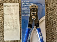
One of the reasons I purchased the new wire strippers is because I was planning to make some repairs on my Renogy 200 watt solar suitcase that I use daily. The wires and MC4 connectors used by Renogy for my system have been experiencing significant use and parts are beginning to break down. Although MC4 connectors are used almost exclusively to daisy chain panels in solar farms I'm not sure if they are the best application for a system which requires high mating cycles. According to Stäubli International AG, an MC4 connector is designed for 100 mating cycles. While performing research I was happy to discover that Anderson Power recently released an IP68 waterproof connector (SBS X-75A) that was designed for 5,000 mating cycles - I may give them a try.

As a temporary connection I used Ancor heat shrink wire connectors that I had on hand. They heat shrinking had not taken place in this picture since I do not have AC power available for my Bosch 15-amp professional heat gun. As soon as I find an electrical connection I will shrink them.
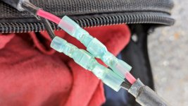
WARNING: If you have a Renogy 200-watt Solar Suitcase make sure to check the condition of your inline fuse and all associated MC4 connectors. During an inspection today I discovered the inline fuse was melted and voltage varied from 5-14 Vdc. My guess is that there was not a good connection between the wires and the inline fuse which resulted in excessive heat that eventually melted the fuse holder. If any electrical experts wish to share more, please do.
I guess what I am happiest about is the fact that this electrical failure did not result in a fire. Although I have fixed the MC4 connectors and the fuse temporarily, I will be contacting Renogy and requesting a replacement wiring harness. This unit has a five year warranty, which is impressive, and was purchased just over one year ago.

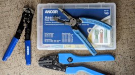
Here is a quick shot of the tools and supplies I used for my field repairs. The system is back up and running now although I am monitoring it. Once I perform a permanent repair I will post an update. Fortunately, the solar system is not functioning while I am sleeping.
Occasionally I will stop in to a laundromat to wash clothes and hang out, talk with locals, discover where the good food is, etc. On this day I stopped at Sherrill coin-op laundromat in Karnes City, Texas. It was a bit on the expensive side for me but it was a nice clean place and is "a long-time family-owned, reliable laundromat conveniently located behind Karnes County National Bank in Karnes City. Our washateria is equipped with plenty of washers and dryers that will leave your laundry fresh and clean." Plus, they have heavy-duty professional grade stainless steel machines which are totally cool with me!

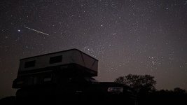
Here is a shot of the night sky while camping for nearly a week on a working cattle ranch in Texas Hill Country. My next update will include additional details but for now, just trust me, it was a wonderfully relaxing and amazingly beautiful time spent with a few other really cool people.
And to wrap things up for this post - here is a video covering the recent SpaceX Starship Integrated Flight Test Three (IFT-3) that I recently attended. Put some headphones on, dial up the resolution, and go full screen. Although the video is amazing, being there in person is so much more. I have been fortunate enough to attend IFT-1, IFT-2, and IFT-3.

One of the reasons I purchased the new wire strippers is because I was planning to make some repairs on my Renogy 200 watt solar suitcase that I use daily. The wires and MC4 connectors used by Renogy for my system have been experiencing significant use and parts are beginning to break down. Although MC4 connectors are used almost exclusively to daisy chain panels in solar farms I'm not sure if they are the best application for a system which requires high mating cycles. According to Stäubli International AG, an MC4 connector is designed for 100 mating cycles. While performing research I was happy to discover that Anderson Power recently released an IP68 waterproof connector (SBS X-75A) that was designed for 5,000 mating cycles - I may give them a try.

As a temporary connection I used Ancor heat shrink wire connectors that I had on hand. They heat shrinking had not taken place in this picture since I do not have AC power available for my Bosch 15-amp professional heat gun. As soon as I find an electrical connection I will shrink them.

WARNING: If you have a Renogy 200-watt Solar Suitcase make sure to check the condition of your inline fuse and all associated MC4 connectors. During an inspection today I discovered the inline fuse was melted and voltage varied from 5-14 Vdc. My guess is that there was not a good connection between the wires and the inline fuse which resulted in excessive heat that eventually melted the fuse holder. If any electrical experts wish to share more, please do.
I guess what I am happiest about is the fact that this electrical failure did not result in a fire. Although I have fixed the MC4 connectors and the fuse temporarily, I will be contacting Renogy and requesting a replacement wiring harness. This unit has a five year warranty, which is impressive, and was purchased just over one year ago.

Here is a quick shot of the tools and supplies I used for my field repairs. The system is back up and running now although I am monitoring it. Once I perform a permanent repair I will post an update. Fortunately, the solar system is not functioning while I am sleeping.

Occasionally I will stop in to a laundromat to wash clothes and hang out, talk with locals, discover where the good food is, etc. On this day I stopped at Sherrill coin-op laundromat in Karnes City, Texas. It was a bit on the expensive side for me but it was a nice clean place and is "a long-time family-owned, reliable laundromat conveniently located behind Karnes County National Bank in Karnes City. Our washateria is equipped with plenty of washers and dryers that will leave your laundry fresh and clean." Plus, they have heavy-duty professional grade stainless steel machines which are totally cool with me!

Here is a shot of the night sky while camping for nearly a week on a working cattle ranch in Texas Hill Country. My next update will include additional details but for now, just trust me, it was a wonderfully relaxing and amazingly beautiful time spent with a few other really cool people.

And to wrap things up for this post - here is a video covering the recent SpaceX Starship Integrated Flight Test Three (IFT-3) that I recently attended. Put some headphones on, dial up the resolution, and go full screen. Although the video is amazing, being there in person is so much more. I have been fortunate enough to attend IFT-1, IFT-2, and IFT-3.
ramblinChet
Drinks Alone
- Joined
- Dec 24, 2020
- Messages
- 477
- Reaction score
- 1,956
I was invited to spend time on a working cattle ranch in Texas Hill Country by Kelly, who also travels full time. We met in Texas last year and then again in Arizona a few months ago. Kelly travels in a Black Series HQ17 that is behind the tree on the right. Lisa, who is also a member of the "Black Series Mafia," joined us at camp; she travels in a HQ15. Both RV campers are really set up well for travel in austere conditions.
The primary reason we are camping at this specific location is because it is perfectly centered along the Path of Totality for the recent Total Solar Eclipse. The weather is not looking favorable but we are having a wonderful time nonetheless.
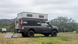
Following a trail to the back forty at Oxford Ranch Campground south of Llano, Texas. This is an awesome private campground for dispersed camping along the 250-mile Texas Hill Country Overland Route which I completed last year.
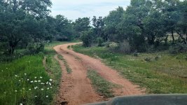
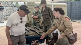
Last year when I was in the Fredericksburg area I spent a day touring the National Museum of the Pacific War. I also walked a few blocks away to the Pacific Combat Zone exhibit which also performs four reenactments each year. Although there were no reenactments on the schedule for when I visited last year, while passing through this year I was happy to discover there was on Saturday prior to the eclipse. Outstanding!!!
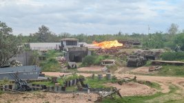
The battle reenactment itself is very loud and features many American and Japanese shoulder fired weapons being shot, a troop deployment from an authentic LCVP (Landing Craft Vehicle Personnel) Higgins boat, shooting from an operating WWII Stuart tank and live fuel action using an authentic WWII flamethrower. Below is an M2 flamethrower being deployed near the end of the reenactment. You don't see many other soldiers up and moving around this late in the event since most have simulated being shot.
They had several nice displays including Jeeps and various firearms and period actors. As first I though, gosh, these are just kids. But then again, it's always the children who fight and die.
"Older men declare war. But it is youth that must fight and die." ~ Herbert Hoover
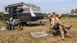
Here is a shot of Lisa and Kelly on the day of the eclipse - we had broken clouds but it was just about perfect during the actual eclipse. Lisa brought along a few sheets of sliver-black polymer which we used to protect ourselves and our equipment when looking up at the sun.
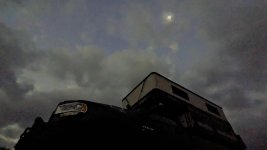
And here is the first ever picture of an AEV Prospector and Four Wheel Camper taken inside the Path of Totality during a Total Solar Eclipse. I didn't have any fancy optics with me but I had my phone so during the eclipse I ran over to my truck, laid on the ground between a fresh cow patty and red fire ant hill, and snapped this shot. Overall we had a great time just hanging out for nearly a week and camping way far back on private property where no one else was.
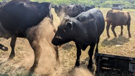
One of the benefits of sleeping on an active cattle ranch is waking up to being surrounded by a herd of cattle. It turns out the cattle discovered the salt spray on my solar panel, presumably from my recent trip to Padre Island National Seashore, and were gathering to lick it clean. I really enjoyed my time at Oxford Ranch Campground and look forward to visiting again.
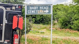
Baby Head Cemetery is just north of Llano, Texas. According to local history, in the mid-1800s, indians captured a young white girl and posted her head on a pike in an effort to scare off settlers. The area became known as Baby Head and eventually a small town with a court house, post office, etc., was established. The town may be gone but the memories and name remains...
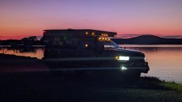
I have began to slowly move north and stopped at another amazing location to watch the sun go down over the lake while listening to the wind and waves. This is how man has lived for nearly all of his existence. Living in a congested area inside tall steel and concrete buildings is unnatural.
Fishermen are dropping boats in the water, dogs are howling, the sun continues to climb and fall, it's been another beautiful day here in Texas. Although I have enjoyed spending winter in the deserts of the southwest, the mountains are calling and I'm not sure how much longer I can resist.
The location I am currently at is so beautiful I am pretty sure I will be here for several days...
The primary reason we are camping at this specific location is because it is perfectly centered along the Path of Totality for the recent Total Solar Eclipse. The weather is not looking favorable but we are having a wonderful time nonetheless.

Following a trail to the back forty at Oxford Ranch Campground south of Llano, Texas. This is an awesome private campground for dispersed camping along the 250-mile Texas Hill Country Overland Route which I completed last year.

Last year when I was in the Fredericksburg area I spent a day touring the National Museum of the Pacific War. I also walked a few blocks away to the Pacific Combat Zone exhibit which also performs four reenactments each year. Although there were no reenactments on the schedule for when I visited last year, while passing through this year I was happy to discover there was on Saturday prior to the eclipse. Outstanding!!!
The battle reenactment itself is very loud and features many American and Japanese shoulder fired weapons being shot, a troop deployment from an authentic LCVP (Landing Craft Vehicle Personnel) Higgins boat, shooting from an operating WWII Stuart tank and live fuel action using an authentic WWII flamethrower. Below is an M2 flamethrower being deployed near the end of the reenactment. You don't see many other soldiers up and moving around this late in the event since most have simulated being shot.

They had several nice displays including Jeeps and various firearms and period actors. As first I though, gosh, these are just kids. But then again, it's always the children who fight and die.
"Older men declare war. But it is youth that must fight and die." ~ Herbert Hoover

Here is a shot of Lisa and Kelly on the day of the eclipse - we had broken clouds but it was just about perfect during the actual eclipse. Lisa brought along a few sheets of sliver-black polymer which we used to protect ourselves and our equipment when looking up at the sun.

And here is the first ever picture of an AEV Prospector and Four Wheel Camper taken inside the Path of Totality during a Total Solar Eclipse. I didn't have any fancy optics with me but I had my phone so during the eclipse I ran over to my truck, laid on the ground between a fresh cow patty and red fire ant hill, and snapped this shot. Overall we had a great time just hanging out for nearly a week and camping way far back on private property where no one else was.

One of the benefits of sleeping on an active cattle ranch is waking up to being surrounded by a herd of cattle. It turns out the cattle discovered the salt spray on my solar panel, presumably from my recent trip to Padre Island National Seashore, and were gathering to lick it clean. I really enjoyed my time at Oxford Ranch Campground and look forward to visiting again.

Baby Head Cemetery is just north of Llano, Texas. According to local history, in the mid-1800s, indians captured a young white girl and posted her head on a pike in an effort to scare off settlers. The area became known as Baby Head and eventually a small town with a court house, post office, etc., was established. The town may be gone but the memories and name remains...

I have began to slowly move north and stopped at another amazing location to watch the sun go down over the lake while listening to the wind and waves. This is how man has lived for nearly all of his existence. Living in a congested area inside tall steel and concrete buildings is unnatural.
Fishermen are dropping boats in the water, dogs are howling, the sun continues to climb and fall, it's been another beautiful day here in Texas. Although I have enjoyed spending winter in the deserts of the southwest, the mountains are calling and I'm not sure how much longer I can resist.
The location I am currently at is so beautiful I am pretty sure I will be here for several days...

Last edited:
ramblinChet
Drinks Alone
- Joined
- Dec 24, 2020
- Messages
- 477
- Reaction score
- 1,956
Traveling full time takes me to places I have never been and introduces me to people I normally would have never met - everyone has a story. One evening, I crossed paths with another man and we struck up a conversation. When you drive an AEV Prospector with a Four Wheel Camper in the bed many are curious to know what I am doing, where I am going, where I have been, etc. I always enjoy telling a story or two but what I really love is to hear the stories others have to share.
When I meet a man I always enjoy hearing about what sort of work they have been associated with over the years. In this particular case the gentleman worked in the control room of a power plant and I had all sorts of questions. After some time he asked if I had a few minutes and since I am a free man who is 100% in control of his own schedule, I replied with a firm yes! He made a quick phone call and said to follow him - we drove out to a location, parked, and he escorted me into a building. A few more secure doors, some long hallways, and here is where we arrived. It felt as if I was on the bridge of intergalactic spaceship - all the information displays which included gauges, controls, etc. This was a very cool place to explore!!!
This man took over an hour to walk me through and explain the significance of the major sections in the control room - keep in mind that the picture below shows maybe 25-30% of the room. We spent much time in the emergency shut-down section and he walked me through various scenarios and how a team of operators must respond. This was a very complex system and I have much respect for the people performing the operations.
Note: this tour took place a very long time ago and is not associated with any of my recent travels.

Possum Kingdom Lake may have a funny name but I am really enjoying camping, relaxing, and exploring this beautiful part of Texas. I planned on staying for a few days but ended up staying a full week. This is how man has lived for nearly all of his existence - outdoors, exposed to the environment, in touch with the natural world. Living in a congested area inside of tall steel and concrete buildings, or even in linear neighborhoods inside of "sticks and bricks," is unnatural.
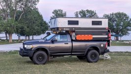
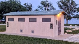
The Brazos River Authority has several lakeside parks with covered pavilions, picnic tables, cooking grills, fire rings, boat ramps, and public restrooms; some with showers. There are also many hiking and biking trails ranging from one to five miles in length with most offering a spectacular view of the lake.
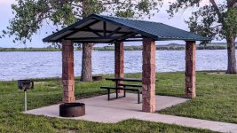
All the people I have met in this clean and orderly area have been very nice. If you are looking for a great place to spend a long weekend or more with the family, the PK area would be tops on my list!
Quick tip: when using your navigation program, search for "BRA area" to quickly locate parks, campgrounds, boat ramps, etc.
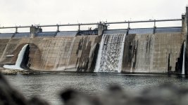
At the eastern end of the reservoir is a 2,700-foot-long and 190-foot-high dam structure called the Morris Sheppard Dam which holds back 540,000 acre-feet of water. Keep in mind that 1 acre-foot equals 325,851 gallons so we have 175,959,540,000 gallons of water ready to flow should the nearly century old dam burst. With that in mind I figured camping at the base of the dam would seem logical. I sent the picture below to my loving mother so she would know where I was spending the night
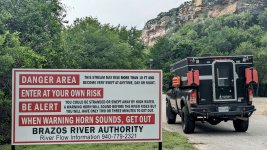
If you have never slept near a dam I would suggest you give it a shot - the sights and sounds are unlike any other. And there is a massive amount of potential energy stored behind that cement wall. What this picture does not show are the hundred or so vultures circling and riding the updraft above the face of the dam. There was a good strong wind so again, there was much energy in the air and the vultures were taking full advantage of it. I sat on a large warm rock at the edge of the river with the wind at my back just watching, and smiling, and enjoying the aerial acrobatics and occasional play between the birds.
It was a free show, entirely unrehearsed, and so mesmerizing. Birds are truly masters of the air...
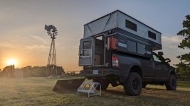
Eventually it was time to depart Possum Kingdom so I pointed my AEV Prospector in a northeasterly direction and traveled around eighty miles to Lyndon B. Johnson National Grasslands. One of my goals over the past six or so months was to slow down and shorten my travels to a reasonable degree. With my primary expenses being gasoline and food I make an effort to control both. Gasoline is easy if I decide to stay in one place by I love to travel and explore so my compromise involves remaining in an area for several days and then only driving a few hours to the next location.
Food is best controlled by preparing all of my meals and only eating when hungry. It does seem we are programmed to perform exactly the opposite of that by eating a minimum of three times per day while most meals are outside the home and prepared by others. That's super expensive! Anyway, there is not much public land in Texas but just north of Dallas and Fort Worth there are national grasslands. These are not huge areas but 20,000 acres each with dirt roads, dispersed camping, etc. I'm there!
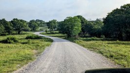
For several nights I slept under the stars within the Cross Timbers Unit. This specific county has the dubious distinction of having more people killed and horses stolen by Indians than any other place in Texas. Caddo Indians were here first, they were pushed out by more aggressive Apache and Comanche tribes. Those tribes were then pushed out by white settlers. Now these United States and Europe are being attacked by globalists who wish to replace and erase all of western civilization.
Despite this, I sleep peacefully each and every night resting assured that this will not happen. Men, approximately 3% of the male population, will not permit this to happen. My message to other men is to focus on correcting issues at the local level. The high-ranking government officials in the news serve only to distract us. We the people have all the power and they are terrified knowing that. Keep your powder dry...
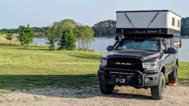
Watching the sun fall asleep just a few hours outside of Dallas and Fort Worth aside a lake in the grasslands. There are three formal campgrounds along with much disbursed camping. These grasslands also contain seventy-five miles of multi-use trails for horseback riding, mountain biking, and hiking. Hunting and fishing are also available along with wildlife viewing and photography.
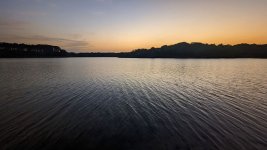
My last sunset in Texas, for now. I woke up in the morning to the sound of cows mooing and birds chirping. Soon I will be crossing into Indian Country and exploring nations within a nation. There is so much to learn about where I am going...
When I meet a man I always enjoy hearing about what sort of work they have been associated with over the years. In this particular case the gentleman worked in the control room of a power plant and I had all sorts of questions. After some time he asked if I had a few minutes and since I am a free man who is 100% in control of his own schedule, I replied with a firm yes! He made a quick phone call and said to follow him - we drove out to a location, parked, and he escorted me into a building. A few more secure doors, some long hallways, and here is where we arrived. It felt as if I was on the bridge of intergalactic spaceship - all the information displays which included gauges, controls, etc. This was a very cool place to explore!!!
This man took over an hour to walk me through and explain the significance of the major sections in the control room - keep in mind that the picture below shows maybe 25-30% of the room. We spent much time in the emergency shut-down section and he walked me through various scenarios and how a team of operators must respond. This was a very complex system and I have much respect for the people performing the operations.
Note: this tour took place a very long time ago and is not associated with any of my recent travels.

Possum Kingdom Lake may have a funny name but I am really enjoying camping, relaxing, and exploring this beautiful part of Texas. I planned on staying for a few days but ended up staying a full week. This is how man has lived for nearly all of his existence - outdoors, exposed to the environment, in touch with the natural world. Living in a congested area inside of tall steel and concrete buildings, or even in linear neighborhoods inside of "sticks and bricks," is unnatural.

The Brazos River Authority has several lakeside parks with covered pavilions, picnic tables, cooking grills, fire rings, boat ramps, and public restrooms; some with showers. There are also many hiking and biking trails ranging from one to five miles in length with most offering a spectacular view of the lake.

All the people I have met in this clean and orderly area have been very nice. If you are looking for a great place to spend a long weekend or more with the family, the PK area would be tops on my list!
Quick tip: when using your navigation program, search for "BRA area" to quickly locate parks, campgrounds, boat ramps, etc.

At the eastern end of the reservoir is a 2,700-foot-long and 190-foot-high dam structure called the Morris Sheppard Dam which holds back 540,000 acre-feet of water. Keep in mind that 1 acre-foot equals 325,851 gallons so we have 175,959,540,000 gallons of water ready to flow should the nearly century old dam burst. With that in mind I figured camping at the base of the dam would seem logical. I sent the picture below to my loving mother so she would know where I was spending the night

If you have never slept near a dam I would suggest you give it a shot - the sights and sounds are unlike any other. And there is a massive amount of potential energy stored behind that cement wall. What this picture does not show are the hundred or so vultures circling and riding the updraft above the face of the dam. There was a good strong wind so again, there was much energy in the air and the vultures were taking full advantage of it. I sat on a large warm rock at the edge of the river with the wind at my back just watching, and smiling, and enjoying the aerial acrobatics and occasional play between the birds.
It was a free show, entirely unrehearsed, and so mesmerizing. Birds are truly masters of the air...

Eventually it was time to depart Possum Kingdom so I pointed my AEV Prospector in a northeasterly direction and traveled around eighty miles to Lyndon B. Johnson National Grasslands. One of my goals over the past six or so months was to slow down and shorten my travels to a reasonable degree. With my primary expenses being gasoline and food I make an effort to control both. Gasoline is easy if I decide to stay in one place by I love to travel and explore so my compromise involves remaining in an area for several days and then only driving a few hours to the next location.
Food is best controlled by preparing all of my meals and only eating when hungry. It does seem we are programmed to perform exactly the opposite of that by eating a minimum of three times per day while most meals are outside the home and prepared by others. That's super expensive! Anyway, there is not much public land in Texas but just north of Dallas and Fort Worth there are national grasslands. These are not huge areas but 20,000 acres each with dirt roads, dispersed camping, etc. I'm there!

For several nights I slept under the stars within the Cross Timbers Unit. This specific county has the dubious distinction of having more people killed and horses stolen by Indians than any other place in Texas. Caddo Indians were here first, they were pushed out by more aggressive Apache and Comanche tribes. Those tribes were then pushed out by white settlers. Now these United States and Europe are being attacked by globalists who wish to replace and erase all of western civilization.
Despite this, I sleep peacefully each and every night resting assured that this will not happen. Men, approximately 3% of the male population, will not permit this to happen. My message to other men is to focus on correcting issues at the local level. The high-ranking government officials in the news serve only to distract us. We the people have all the power and they are terrified knowing that. Keep your powder dry...

Watching the sun fall asleep just a few hours outside of Dallas and Fort Worth aside a lake in the grasslands. There are three formal campgrounds along with much disbursed camping. These grasslands also contain seventy-five miles of multi-use trails for horseback riding, mountain biking, and hiking. Hunting and fishing are also available along with wildlife viewing and photography.

My last sunset in Texas, for now. I woke up in the morning to the sound of cows mooing and birds chirping. Soon I will be crossing into Indian Country and exploring nations within a nation. There is so much to learn about where I am going...

ramblinChet
Drinks Alone
- Joined
- Dec 24, 2020
- Messages
- 477
- Reaction score
- 1,956
Goodbye Texas and hello Oklahoma! After spending seven weeks in Texas where I enjoyed another Starship launch, relaxed at Padre Island National Seashore, and watched the total solar eclipse within the path of totality with friends on a cattle ranch, it was time to ramble on.
While passing through Chickasaw Nation I stopped at Fort Washita Historic Site and noticed this book: The Prairie Traveler. This historical book is "a hand-book for overland expeditions. With maps, illustrations, and itineraries of the principal routes between the Mississippi and the Pacific." For my second night in the Sooner State I found a spot to camp along Atoka Reservoir inside Choctaw Nation. The big name associated with the nearby towns of Atoka, Kiowa, and McAlester is Reba McEntire who most recognize as a famous country music singer. Reba even has a nice restaurant in Atoka named Reba's Place - next time I am passing through I will stop and try the chicken fried steak!
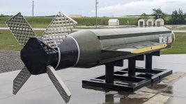
Some may not realize that McAlester Army Ammunition Plant is in McAlester, Oklahoma are responsible for manufacturing the GBU-43/B MOAB (Mother Of All Bombs). This is the largest conventional weapon ever used in combat and produces a yield equivalent to a small tactical nuclear weapon.
The particular weapon has always been interesting to me since I was in the area when the first one was tested on Eglin AFB back in 2003. What few realize is that prior the "first test" that was publicly announced there was an identical test approximately one week earlier that was secret. By the way, those grid fins on the rear - a Russian invention, amazing. Yes, I am an aeronautics geek!
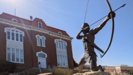
Moving to the east I entered the Choctaw Nation - this is Tvshka Homma, which means "Red Warrior." The building was also the Choctaw Capitol building until 1907 when the Tribal government was dissolved and the Federal government took control. All bricks were manufactured on site using clay from nearby. The sandstone sills were also from the area as was all wood used.
This is the Tribal Court where I sat for some time trying to imagine what historical discussions, debates, and decisions, took place here. I love visiting historic places such as this and just relaxing trying to imagine what took place in the past. Upstairs is the Choctaw Nation Museum and the section I enjoyed the most featured the "code talkers" of WWI and WWII.

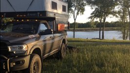
Here I am camped beside Nanih Waiya Lake in the Choctaw Nation preparing for my next overland adventure. This lake was named after a sacred location in Mississippi called Inholitopa iski, or "mother mound," where some believe the first Choctaw was born into this world. Nanih Waiya was also the name of their first capitol in Indian Territory after being forced to move from Mississippi to current day Oklahoma in 1838. There's so much history everywhere I go an I just love learning about everything.
My next adventure will begin in Oklahoma and end in central Arkansas - I will spend much time in the mountains alone 'cause I'm an Indian outlaw...
While passing through Chickasaw Nation I stopped at Fort Washita Historic Site and noticed this book: The Prairie Traveler. This historical book is "a hand-book for overland expeditions. With maps, illustrations, and itineraries of the principal routes between the Mississippi and the Pacific." For my second night in the Sooner State I found a spot to camp along Atoka Reservoir inside Choctaw Nation. The big name associated with the nearby towns of Atoka, Kiowa, and McAlester is Reba McEntire who most recognize as a famous country music singer. Reba even has a nice restaurant in Atoka named Reba's Place - next time I am passing through I will stop and try the chicken fried steak!

Some may not realize that McAlester Army Ammunition Plant is in McAlester, Oklahoma are responsible for manufacturing the GBU-43/B MOAB (Mother Of All Bombs). This is the largest conventional weapon ever used in combat and produces a yield equivalent to a small tactical nuclear weapon.
The particular weapon has always been interesting to me since I was in the area when the first one was tested on Eglin AFB back in 2003. What few realize is that prior the "first test" that was publicly announced there was an identical test approximately one week earlier that was secret. By the way, those grid fins on the rear - a Russian invention, amazing. Yes, I am an aeronautics geek!

Moving to the east I entered the Choctaw Nation - this is Tvshka Homma, which means "Red Warrior." The building was also the Choctaw Capitol building until 1907 when the Tribal government was dissolved and the Federal government took control. All bricks were manufactured on site using clay from nearby. The sandstone sills were also from the area as was all wood used.

This is the Tribal Court where I sat for some time trying to imagine what historical discussions, debates, and decisions, took place here. I love visiting historic places such as this and just relaxing trying to imagine what took place in the past. Upstairs is the Choctaw Nation Museum and the section I enjoyed the most featured the "code talkers" of WWI and WWII.

Here I am camped beside Nanih Waiya Lake in the Choctaw Nation preparing for my next overland adventure. This lake was named after a sacred location in Mississippi called Inholitopa iski, or "mother mound," where some believe the first Choctaw was born into this world. Nanih Waiya was also the name of their first capitol in Indian Territory after being forced to move from Mississippi to current day Oklahoma in 1838. There's so much history everywhere I go an I just love learning about everything.
My next adventure will begin in Oklahoma and end in central Arkansas - I will spend much time in the mountains alone 'cause I'm an Indian outlaw...

ramblinChet
Drinks Alone
- Joined
- Dec 24, 2020
- Messages
- 477
- Reaction score
- 1,956
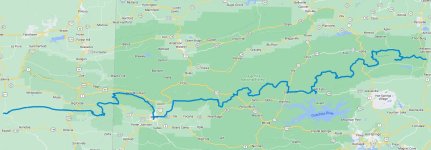
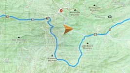
My most recent overland adventure was the Ouachita Traverse which begins in the Choctaw Nation in southeast Oklahoma, and ends just outside Little Rock, Arkansas.. The trail lasted five days, mileage totaled 300, and actual drive time was 18 hours - I am working to slow my pace and enjoy more of my adventures. Nearly all of the time was spent driving on dirt, gravel, or mud, roads and trails. Some were well maintained whereas two sections totaling 50 miles were very rough and unmaintained.
This overland trail passes through the Ouachita National Forest which totals 1.8 million acres and just in case you are wondering, Ouachita is pronounced wash-ah-tah. History shows that some of the first explorers to interact with Native American Indians in this area were French and this helps to explain the interesting French spelling of an Indian word. The trail was a bit more than expected compared to the limited information I was able to collect beforehand. I imagined this would be all gravel roads with a few water crossings. Some of it was not, although I really enjoyed that trail and the challenges associated with it.
Day one of my adventure was not what I expected - the first 35 miles took five hours of very intense driving and navigation to complete. These first miles would be perfect for a Jeep or naked mid-sized truck, as long as you do not mind endless scratches. If you drive a full size rig with a popup camper you can expect damage. Driving between trees so tight that they fold your mirrors, and dragging 1-2" branches down the side and over the top, is ok for a few feet here and there. But driving in those conditions for several miles at a time, it's really hard on you and your vehicle. I have been off-roading off and on for 30+ years and this is the tightest and longest section I have ever traveled. I would have liked to take a picture but was unable to open the door and much of the time the trees were so close together I was unable to squeeze between them if I crawled out the window. And to be honest, after a few hours, I just wanted to get back to open trail.
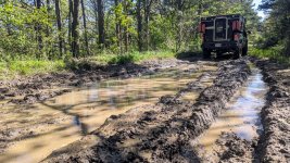
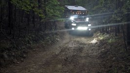
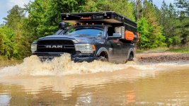
Sections of the trail opened up while traversing the ridge-line of the Kiamichi Mountains I passed through several dozen large puddles. Average depth was around one foot and while most had firm bottoms, a few were soft and muddy. Here is the worst of the muddy ones - for reference, I drove at a moderate speed through all in two wheel drive. My guess is in the rainy season the conditions could be significantly worse.
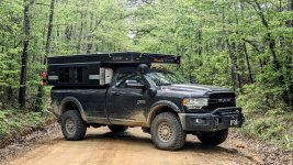
The road has been tough for my AEV Prospector and Four Wheel Camper so once we broke out into some open space and the remainder of the trail "appeared" to be easy, I figured I would take a picture of this workhorse. I do my best to avoid and minimize damage to my rig but I bought her to use her and therefore, am not shy when it comes to bumps or bruises. Interesting fact - while traveling through the mountains I crossed back and forth between Arkansas and Oklahoma at least five times!
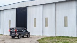
This is an empty hangar at Mena Intermountain Municipal Airport where Barry Seals C-123K Provider aircraft flew out carrying illegal machine guns and missiles to the Contras in Nicaragua, which were then knowingly trafficked to Iran in exchange for money. Some of that money was then used to support the Contras while the rest was used by the CIA to fund other illegal and more importantly, untraceable, operations. Once the arms were dropped in Nicaragua, Barry would then fly to meet with the Medellín Cartel in Colombia, load up with drugs (primarily cocaine), and fly back to Mena, with the approval from then Governor Bill Clinton. The drugs would then be sold to high-level drug traffickers in these United States for distribution through the US with the drug money once again being used by our CIA to fund additional illegal operations both here and abroad.
Interestingly enough, there was a certain strange feeling of sorts felt while exploring this still active airport. A number of private vehicles that passed by slowed to take a closer look and then minutes later, two airport security vehicles came by. My guess was that word spread fast that a serialized AEV Prospector was on the flight-line and folks wanted to check this beauty out. You can find additional information on the Iran-Contra Affair to include specifics on the CIA, NSA, DEA, etc. involvement if you dig around. The truth is out there and if you still believe our despotic government staffed by thousands of psychopathic individuals still care about us common folk...unfortunately, you are dead wrong.
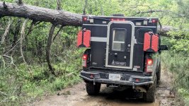
Trees are something you should be prepared to deal with if you plan to drive hundreds of miles through the mountains. Some are small and simple enough to cut with a handsaw while others would require a chainsaw, winch, and log chain to move. This one was just too big and would take such a long time to clear I opted once again to navigate around. Cutting and moving a large tree weighing 5,000-7,000 pounds containing so much potential energy is a dangerous exercise and really should only be attempted with multiple people when time is not a critical consideration.
When overlanding you must always be prepared for navigating around a washed out bridge, massive tree blocking the trail, etc. In this case FS774 had a locked gate and although there was a clear path where others had been driving around the gate, I respected the closure and opted to review my map and navigate around. Having an uncluttered cockpit with Gaia mapping software being displayed directly on my factory Uconnect 8.4-inch with touchscreen is clean and simple.
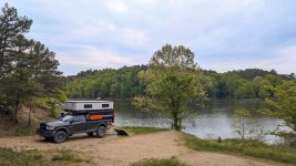
After spending a few days on the trail I jumped off to refuel at Mount Ida and since Lake Ouachita was along the way I decided to spend time there. This is my new camp on one of the coves off of Lake Ouachita. This is a quiet little place and the trail coming in is rough and overgrown confirming that it is seldom used. I can imagine there are dozens of primitive camp spots just like this surrounding the lake.
For most people these days, sleeping outdoors is an unusual event - this is sad. Since it is normal for me to sleep in the forest, mountains, desert, etc., I rarely stop to think of how different the natural and pure world is when compared to the man made make-believe one that I once lived in.
Consider this - everything I feel, see, hear, touch, and smell is real. None of this is a digital recreation; none of this is temporary or make-believe. Come outside into the real world, enjoy the truth, see what God has created for us to enjoy. Escape from digital prison and join myself and others in the wild. Once you arrive you will understand...
Matthew 6:25-34
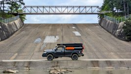
If you have a chance to drive across a spillway below a dam would you? After completing the trail I drove a few miles south to visit Lake Winona and drove across the spillway with a smile listening to a funny song by Primus.
Later this year, or sometime next year, I plan to return to this area of the country to explore the Ozark Mountains in greater detail. It may have been last year, or the year prior, that I enjoyed some trails in the Ozarks but I promised to return and spend a month or so exploring more.
Here is a dynamic shot of my AEV Prospector crossing a typical puddle along the trail. It's best to be in 1st or 2nd gear and in low range so you can keep the engine RPMs up which creates higher exhaust back pressure, a smoother running engine, and minimization of a potential stall. Move forward fast enough to create a bow wave but not a splash.
Each of us must ask ourselves when we are on our deathbed, will we smile knowing we are rich with material objects, or will we smile being rich with memories? I consider myself a rich man, not rich with money, but memories. Spend more time with your family outdoors and create everlasting memories...
This overland trail passes through the Ouachita National Forest which totals 1.8 million acres and just in case you are wondering, Ouachita is pronounced wash-ah-tah. History shows that some of the first explorers to interact with Native American Indians in this area were French and this helps to explain the interesting French spelling of an Indian word. The trail was a bit more than expected compared to the limited information I was able to collect beforehand. I imagined this would be all gravel roads with a few water crossings. Some of it was not, although I really enjoyed that trail and the challenges associated with it.

Day one of my adventure was not what I expected - the first 35 miles took five hours of very intense driving and navigation to complete. These first miles would be perfect for a Jeep or naked mid-sized truck, as long as you do not mind endless scratches. If you drive a full size rig with a popup camper you can expect damage. Driving between trees so tight that they fold your mirrors, and dragging 1-2" branches down the side and over the top, is ok for a few feet here and there. But driving in those conditions for several miles at a time, it's really hard on you and your vehicle. I have been off-roading off and on for 30+ years and this is the tightest and longest section I have ever traveled. I would have liked to take a picture but was unable to open the door and much of the time the trees were so close together I was unable to squeeze between them if I crawled out the window. And to be honest, after a few hours, I just wanted to get back to open trail.
Sections of the trail opened up while traversing the ridge-line of the Kiamichi Mountains I passed through several dozen large puddles. Average depth was around one foot and while most had firm bottoms, a few were soft and muddy. Here is the worst of the muddy ones - for reference, I drove at a moderate speed through all in two wheel drive. My guess is in the rainy season the conditions could be significantly worse.

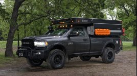
The road has been tough for my AEV Prospector and Four Wheel Camper so once we broke out into some open space and the remainder of the trail "appeared" to be easy, I figured I would take a picture of this workhorse. I do my best to avoid and minimize damage to my rig but I bought her to use her and therefore, am not shy when it comes to bumps or bruises. Interesting fact - while traveling through the mountains I crossed back and forth between Arkansas and Oklahoma at least five times!

This is an empty hangar at Mena Intermountain Municipal Airport where Barry Seals C-123K Provider aircraft flew out carrying illegal machine guns and missiles to the Contras in Nicaragua, which were then knowingly trafficked to Iran in exchange for money. Some of that money was then used to support the Contras while the rest was used by the CIA to fund other illegal and more importantly, untraceable, operations. Once the arms were dropped in Nicaragua, Barry would then fly to meet with the Medellín Cartel in Colombia, load up with drugs (primarily cocaine), and fly back to Mena, with the approval from then Governor Bill Clinton. The drugs would then be sold to high-level drug traffickers in these United States for distribution through the US with the drug money once again being used by our CIA to fund additional illegal operations both here and abroad.
Interestingly enough, there was a certain strange feeling of sorts felt while exploring this still active airport. A number of private vehicles that passed by slowed to take a closer look and then minutes later, two airport security vehicles came by. My guess was that word spread fast that a serialized AEV Prospector was on the flight-line and folks wanted to check this beauty out. You can find additional information on the Iran-Contra Affair to include specifics on the CIA, NSA, DEA, etc. involvement if you dig around. The truth is out there and if you still believe our despotic government staffed by thousands of psychopathic individuals still care about us common folk...unfortunately, you are dead wrong.

Trees are something you should be prepared to deal with if you plan to drive hundreds of miles through the mountains. Some are small and simple enough to cut with a handsaw while others would require a chainsaw, winch, and log chain to move. This one was just too big and would take such a long time to clear I opted once again to navigate around. Cutting and moving a large tree weighing 5,000-7,000 pounds containing so much potential energy is a dangerous exercise and really should only be attempted with multiple people when time is not a critical consideration.

When overlanding you must always be prepared for navigating around a washed out bridge, massive tree blocking the trail, etc. In this case FS774 had a locked gate and although there was a clear path where others had been driving around the gate, I respected the closure and opted to review my map and navigate around. Having an uncluttered cockpit with Gaia mapping software being displayed directly on my factory Uconnect 8.4-inch with touchscreen is clean and simple.

After spending a few days on the trail I jumped off to refuel at Mount Ida and since Lake Ouachita was along the way I decided to spend time there. This is my new camp on one of the coves off of Lake Ouachita. This is a quiet little place and the trail coming in is rough and overgrown confirming that it is seldom used. I can imagine there are dozens of primitive camp spots just like this surrounding the lake.

For most people these days, sleeping outdoors is an unusual event - this is sad. Since it is normal for me to sleep in the forest, mountains, desert, etc., I rarely stop to think of how different the natural and pure world is when compared to the man made make-believe one that I once lived in.
Consider this - everything I feel, see, hear, touch, and smell is real. None of this is a digital recreation; none of this is temporary or make-believe. Come outside into the real world, enjoy the truth, see what God has created for us to enjoy. Escape from digital prison and join myself and others in the wild. Once you arrive you will understand...
Matthew 6:25-34

If you have a chance to drive across a spillway below a dam would you? After completing the trail I drove a few miles south to visit Lake Winona and drove across the spillway with a smile listening to a funny song by Primus.
Later this year, or sometime next year, I plan to return to this area of the country to explore the Ozark Mountains in greater detail. It may have been last year, or the year prior, that I enjoyed some trails in the Ozarks but I promised to return and spend a month or so exploring more.

Here is a dynamic shot of my AEV Prospector crossing a typical puddle along the trail. It's best to be in 1st or 2nd gear and in low range so you can keep the engine RPMs up which creates higher exhaust back pressure, a smoother running engine, and minimization of a potential stall. Move forward fast enough to create a bow wave but not a splash.
Each of us must ask ourselves when we are on our deathbed, will we smile knowing we are rich with material objects, or will we smile being rich with memories? I consider myself a rich man, not rich with money, but memories. Spend more time with your family outdoors and create everlasting memories...

Last edited:
listening to a funny song by Primus.
Southbound Pachyderm would have been a good theme too.
Users who are viewing this thread
Total: 2 (members: 0, guests: 2)
